Tengah geodata
Tengah (East Java) is a seat of a fourth-order administrative division; located in Indonesia in Asia/Jakarta (GMT+7) time zone. In our database, there are 407 cities with bigger population. Compared to other cities in Indonesia, 69.8% of cities are located further ↓South; 60.8% of cities are located further ←West and 56.4% of cities have lower elevation than Tengah. Note1


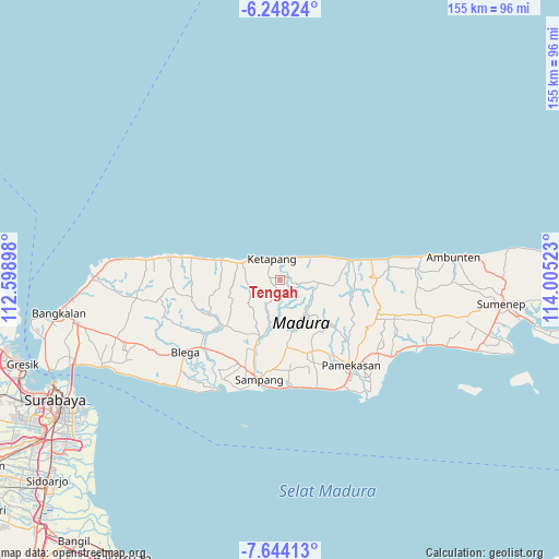
Tengah GPS coordinates[2]
6° 56' 48.12" South, 113° 18' 7.56" East
| Map corner | latitude | longitude |
|---|---|---|
| Upper-left | -6.24824°, | 112.59898° |
| Center: | -6.9467°, | 113.3021° |
| Lower-right: | -7.64413°, | 114.00523° |
| Map W x H: | 155.2×155.2 km | = 96.4×96.4mi |
| max Lat: | 5.88969° ⇑30.2% North |
| Tengah: | -6.9467° |
| min Lat: | ⇓69.8% South -10.934° |
| min Long | Tengah | max Long |
| 95.1345° | 113.3021° | 140.9419° |
| W 60.8%⇐ | ⇒39.2% E |
Elevation
Elevation of Tengah is 133 m = 436 ft, and this is 96.7 m = 317 ft below average elevation for this country.
| Max E: |
3185 m = 10449 ft | 43.6% |
| Avg. | 229.7 m = 754 ft | |
| Tengah | 133 m = 436 ft | |
Min E: |
-1 m = -3 ft | 56.4% |
See also: Indonesia elevation on elevation.city.
Geographical zone
Tengah is located in South Torrid zone (between Equator and Tropic of Capricorn). Distance of Equator is 772.4 km =479.9 mi to North.| Distance of | km | miles | from Tengah |
|---|---|---|---|
| Equator | 772.4 | 479.9 | to North |
| Tropic Capricorn | 1833.5 | 1139.3 | to South |
| Antarctic Circle | 6628.8 | 4118.9 | to South |
| South Pole | 9234.7 | 5738.2 | to South |


Nearby cities:
15 places around Tengah: (largest is in red/bold)
• Dampol
6.7 km =4.2 mi,  303°
303°
• Derbing
7.2 km =4.5 mi,  221°
221°
• Duk Timur
6.2 km =3.9 mi,  344°
344°
• Gilin
5.8 km =3.6 mi,  12°
12°
• Jalgung
6.1 km =3.8 mi,  202°
202°
• Kemereh
6.2 km =3.9 mi,  84°
84°
• Kemiri Daya
4.2 km =2.6 mi,  232°
232°
• Ketapang
6.1 km =3.8 mi, 337°
• Lekedalem
4.5 km =2.8 mi,  143°
143°
• Nanger
4.1 km =2.5 mi,  173°
173°
• Robatal
6.5 km =4 mi, 202°
• Sorren Daya
5.2 km =3.2 mi, 299°
• Sumberbakti
6.5 km =4 mi,  330°
330°
• Taman
4.8 km =3 mi, 328°
• Tengah
2 km =1.2 mi,  287°
287°
Sources, notices
• [Note1] Compared only with cities in Indonesia existing in our database
• [Src1] Map data: © OpenStreetMap contributors (CC-BY-SA)
• [Src2] Other city data from geonames.org with taken over terms of usage.
• [Src3] Geographical zone / Annual Mean Temperature by Robert A. Rohde @ Wikipedia
