Danpateh geodata
Danpateh (East Java) is a seat of a fourth-order administrative division; located in Indonesia in Asia/Jakarta (GMT+7) time zone. In our database, there are 407 cities with bigger population. Compared to other cities in Indonesia, 70.7% of cities are located further ↓South; 62.7% of cities are located further ←West and 59.7% of cities have lower elevation than Danpateh. Note1


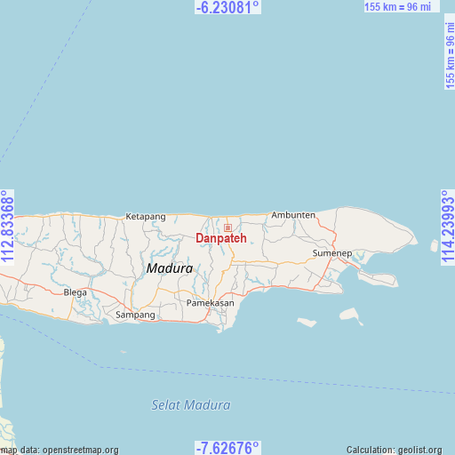
Danpateh GPS coordinates[2]
6° 55' 45.48" South, 113° 32' 12.48" East
| Map corner | latitude | longitude |
|---|---|---|
| Upper-left | -6.23081°, | 112.83368° |
| Center: | -6.9293°, | 113.5368° |
| Lower-right: | -7.62676°, | 114.23993° |
| Map W x H: | 155.2×155.2 km | = 96.4×96.4mi |
| max Lat: | 5.88969° ⇑29.3% North |
| Danpateh: | -6.9293° |
| min Lat: | ⇓70.7% South -10.934° |
| min Long | Danpateh | max Long |
| 95.1345° | 113.5368° | 140.9419° |
| W 62.7%⇐ | ⇒37.3% E |
Elevation
Elevation of Danpateh is 160 m = 525 ft, and this is 69.7 m = 229 ft below average elevation for this country.
| Max E: |
3185 m = 10449 ft | 40.3% |
| Avg. | 229.7 m = 754 ft | |
| Danpateh | 160 m = 525 ft | |
Min E: |
-1 m = -3 ft | 59.7% |
See also: Indonesia elevation on elevation.city.
Geographical zone
Danpateh is located in South Torrid zone (between Equator and Tropic of Capricorn). Distance of Equator is 770.5 km =478.8 mi to North.| Distance of | km | miles | from Danpateh |
|---|---|---|---|
| Equator | 770.5 | 478.8 | to North |
| Tropic Capricorn | 1835.5 | 1140.5 | to South |
| Antarctic Circle | 6630.7 | 4120.1 | to South |
| South Pole | 9236.6 | 5739.4 | to South |


Nearby cities:
15 places around Danpateh: (largest is in red/bold)
• Baban
5.1 km =3.2 mi,  273°
273°
• Brumbung Laok
2.3 km =1.4 mi,  276°
276°
• Gunungtengah
4.3 km =2.7 mi,  157°
157°
• Laokgunung
5.5 km =3.4 mi,  113°
113°
• Oro Timur
5.4 km =3.4 mi,  45°
45°
• Pregi
5.8 km =3.6 mi,  176°
176°
• Rapas
2.8 km =1.7 mi,  253°
253°
• Rokem Barat
3.6 km =2.2 mi,  350°
350°
• Sangoleng
4.1 km =2.5 mi,  322°
322°
• Telangi Satu
2.1 km =1.3 mi,  148°
148°
• Tengah
1 km =0.6 mi,  357°
357°
• Tengah
1.6 km =1 mi,  97°
97°
• Timur Dajah
3.9 km =2.4 mi,  335°
335°
• Wakduwa’ Barat
1.5 km =0.9 mi,  223°
223°
• Waru
2 km =1.2 mi,  134°
134°
Sources, notices
• [Note1] Compared only with cities in Indonesia existing in our database
• [Src1] Map data: © OpenStreetMap contributors (CC-BY-SA)
• [Src2] Other city data from geonames.org with taken over terms of usage.
• [Src3] Geographical zone / Annual Mean Temperature by Robert A. Rohde @ Wikipedia
