Gunung Timur geodata
Gunung Timur (East Java) is a seat of a fourth-order administrative division; located in Indonesia in Asia/Jakarta (GMT+7) time zone. In our database, there are 407 cities with bigger population. Compared to other cities in Indonesia, 73.8% of cities are located further ↓South; 66.4% of cities are located further ←West and 51.4% of cities have higher elevation than Gunung Timur. Note1


Gunung Timur GPS coordinates[2]
6° 53' 2.04" South, 113° 53' 27.24" East
| Map corner | latitude | longitude |
|---|---|---|
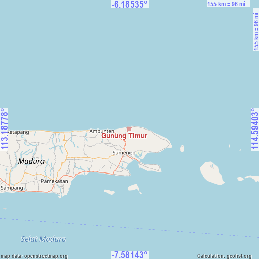
| Upper-left | -6.18535°, | 113.18778° |
| Center: | -6.8839°, | 113.8909° |
| Lower-right: | -7.58143°, | 114.59403° |
| Map W x H: | 155.2×155.2 km | = 96.4×96.4mi |
| max Lat: | 5.88969° ⇑26.2% North |
| Gunung Timur: | -6.8839° |
| min Lat: | ⇓73.8% South -10.934° |
| min Long | Gunung Timur | max Long |
| 95.1345° | 113.8909° | 140.9419° |
| W 66.4%⇐ | ⇒33.6% E |
Elevation
Elevation of Gunung Timur is 97 m = 318 ft, and this is 132.7 m = 435 ft below average elevation for this country.
| Max E: |
3185 m = 10449 ft | 51.4% |
| Avg. | 229.7 m = 754 ft | |
| Gunung Timur | 97 m = 318 ft | |
Min E: |
-1 m = -3 ft | 48.6% |
See also: Indonesia elevation on elevation.city.
Geographical zone
Gunung Timur is located in South Torrid zone (between Equator and Tropic of Capricorn). Distance of Equator is 765.4 km =475.6 mi to North.| Distance of | km | miles | from Gunung Timur |
|---|---|---|---|
| Equator | 765.4 | 475.6 | to North |
| Tropic Capricorn | 1840.5 | 1143.6 | to South |
| Antarctic Circle | 6635.8 | 4123.3 | to South |
| South Pole | 9241.6 | 5742.5 | to South |


Nearby cities:
15 places around Gunung Timur: (largest is in red/bold)
• Batuputih
4.6 km =2.9 mi,  140°
140°
• Bulubarat
3.1 km =1.9 mi,  75°
75°
• Bungereng
3.7 km =2.3 mi,  226°
226°
• Canggetelo
2.8 km =1.7 mi,  199°
199°
• Gunungpapan
7.2 km =4.5 mi,  89°
89°
• Jungjungan
8.1 km =5 mi, 225°
• Jurak Lao’
7.8 km =4.8 mi,  109°
109°
• Karangpocok
6.3 km =3.9 mi, 229°
• Kombang
5.8 km =3.6 mi,  253°
253°
• Manding
8 km =5 mi, 195°
• Marang
4.7 km =2.9 mi,  179°
179°
• Nyapar
7 km =4.3 mi, 249°
• Panjeran
6.1 km =3.8 mi,  120°
120°
• Talondang
1.5 km =0.9 mi,  67°
67°
• Teramu
5.1 km =3.2 mi,  164°
164°
Sources, notices
• [Note1] Compared only with cities in Indonesia existing in our database
• [Src1] Map data: © OpenStreetMap contributors (CC-BY-SA)
• [Src2] Other city data from geonames.org with taken over terms of usage.
• [Src3] Geographical zone / Annual Mean Temperature by Robert A. Rohde @ Wikipedia
