Letkole geodata
Letkole (East Nusa Tenggara) is a seat of a fourth-order administrative division; located in Indonesia in Asia/Makassar (GMT+8) time zone. In our database, there are 407 cities with bigger population. Compared to other cities in Indonesia, 94.6% of cities are located further ↑North; 93.8% of cities are located further ←West and 55.8% of cities have lower elevation than Letkole. Note1


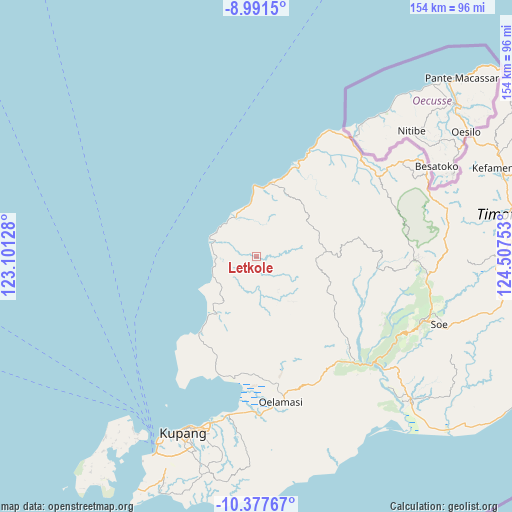
Letkole GPS coordinates[2]
9° 41' 7.08" South, 123° 48' 15.84" East
| Map corner | latitude | longitude |
|---|---|---|
| Upper-left | -8.9915°, | 123.10128° |
| Center: | -9.6853°, | 123.8044° |
| Lower-right: | -10.37767°, | 124.50753° |
| Map W x H: | 154.1×154.1 km | = 95.8×95.8mi |
| max Lat: | 5.88969° ⇑94.6% North |
| Letkole: | -9.6853° |
| min Lat: | ⇓5.4% South -10.934° |
| min Long | Letkole | max Long |
| 95.1345° | 123.8044° | 140.9419° |
| W 93.8%⇐ | ⇒6.2% E |
Elevation
Elevation of Letkole is 129 m = 423 ft, and this is 100.7 m = 330 ft below average elevation for this country.
| Max E: |
3185 m = 10449 ft | 44.2% |
| Avg. | 229.7 m = 754 ft | |
| Letkole | 129 m = 423 ft | |
Min E: |
-1 m = -3 ft | 55.8% |
See also: Indonesia elevation on elevation.city.
Geographical zone
Letkole is located in South Torrid zone (between Equator and Tropic of Capricorn). Distance of Equator is 1076.9 km =669.2 mi to North.| Distance of | km | miles | from Letkole |
|---|---|---|---|
| Equator | 1076.9 | 669.2 | to North |
| Tropic Capricorn | 1529 | 950.1 | to South |
| Antarctic Circle | 6324.3 | 3929.7 | to South |
| South Pole | 8930.2 | 5549 | to South |


Nearby cities:
15 places around Letkole: (largest is in red/bold)
• Anoek
20.6 km =12.8 mi,  99°
99°
• Bitobe
20.8 km =12.9 mi,  73°
73°
• Fatumetan
17.3 km =10.7 mi,  110°
110°
• Fatupael
16.7 km =10.4 mi, 97°
• Huelkail
22.7 km =14.1 mi, 72°
• Kaem
11.9 km =7.4 mi,  145°
145°
• Kasmabaki
13.3 km =8.3 mi,  277°
277°
• Leloboko
13.7 km =8.5 mi, 97°
• Lelogama
16.7 km =10.4 mi, 100°
• Naisano Dua
10.4 km =6.5 mi,  338°
338°
• Nefoneut
3 km =1.9 mi,  195°
195°
• Oelbanu
10.6 km =6.6 mi, 102°
• Siumate
21.2 km =13.2 mi,  215°
215°
• Taen Tengah
14.2 km =8.8 mi,  290°
290°
• Taimaman
17.3 km =10.7 mi,  141°
141°
Sources, notices
• [Note1] Compared only with cities in Indonesia existing in our database
• [Src1] Map data: © OpenStreetMap contributors (CC-BY-SA)
• [Src2] Other city data from geonames.org with taken over terms of usage.
• [Src3] Geographical zone / Annual Mean Temperature by Robert A. Rohde @ Wikipedia
