Meobesi geodata
Meobesi (East Nusa Tenggara) is a seat of a fourth-order administrative division; located in Indonesia in Asia/Makassar (GMT+8) time zone. In our database, there are 407 cities with bigger population. Compared to other cities in Indonesia, 95.8% of cities are located further ↑North; 94.4% of cities are located further ←West and 66.2% of cities have lower elevation than Meobesi. Note1


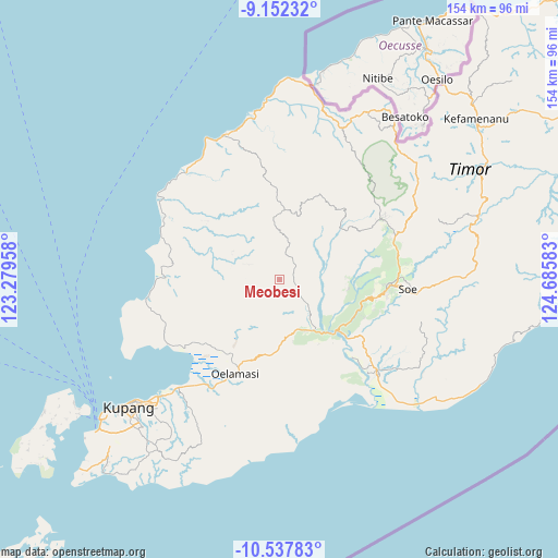
Meobesi GPS coordinates[2]
9° 50' 44.88" South, 123° 58' 57.72" East
| Map corner | latitude | longitude |
|---|---|---|
| Upper-left | -9.15232°, | 123.27958° |
| Center: | -9.8458°, | 123.9827° |
| Lower-right: | -10.53783°, | 124.68583° |
| Map W x H: | 154.1×154.1 km | = 95.8×95.8mi |
| max Lat: | 5.88969° ⇑95.8% North |
| Meobesi: | -9.8458° |
| min Lat: | ⇓4.2% South -10.934° |
| min Long | Meobesi | max Long |
| 95.1345° | 123.9827° | 140.9419° |
| W 94.4%⇐ | ⇒5.6% E |
Elevation
Elevation of Meobesi is 240 m = 787 ft, and this is 10.3 m = 34 ft above average elevation for this country.
| Max E: |
3185 m = 10449 ft | 33.8% |
| Meobesi | 240 m 787 ft | |
| Avg. | 229.7 m = 754 ft | |
Min E: |
-1 m = -3 ft | 66.2% |
See also: Indonesia elevation on elevation.city.
Geographical zone
Meobesi is located in South Torrid zone (between Equator and Tropic of Capricorn). Distance of Equator is 1094.8 km =680.3 mi to North.| Distance of | km | miles | from Meobesi |
|---|---|---|---|
| Equator | 1094.8 | 680.3 | to North |
| Tropic Capricorn | 1511.2 | 939 | to South |
| Antarctic Circle | 6306.4 | 3918.6 | to South |
| South Pole | 8912.3 | 5537.8 | to South |


Nearby cities:
15 places around Meobesi: (largest is in red/bold)
• Anoek
14.3 km =8.9 mi,  3°
3°
• Bokong Timur
16.5 km =10.3 mi,  148°
148°
• Bonak
10.9 km =6.8 mi,  240°
240°
• Ekateta
14.4 km =8.9 mi,  195°
195°
• Fatumetan
12.2 km =7.6 mi,  343°
343°
• Fatupael
15.9 km =9.9 mi,  349°
349°
• Hueknutu
4.5 km =2.8 mi,  107°
107°
• Kaem
15.1 km =9.4 mi,  302°
302°
• Koa
15.1 km =9.4 mi,  128°
128°
• Kusbese
11.5 km =7.1 mi,  170°
170°
• Leloboko
17.2 km =10.7 mi, 339°
• Lelogama
15.3 km =9.5 mi, 348°
• Oepula
6.4 km =4 mi,  34°
34°
• Taimaman
9.8 km =6.1 mi, 295°
• Takari
15.8 km =9.8 mi, 153°
Sources, notices
• [Note1] Compared only with cities in Indonesia existing in our database
• [Src1] Map data: © OpenStreetMap contributors (CC-BY-SA)
• [Src2] Other city data from geonames.org with taken over terms of usage.
• [Src3] Geographical zone / Annual Mean Temperature by Robert A. Rohde @ Wikipedia
