Kengkang geodata
Kengkang (East Java) is a seat of a fourth-order administrative division; located in Indonesia in Asia/Jakarta (GMT+7) time zone. In our database, there are 407 cities with bigger population. Compared to other cities in Indonesia, 58.2% of cities are located further ↓South; 69.3% of cities are located further ←West and 61.8% of cities have higher elevation than Kengkang. Note1


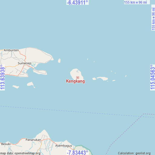
Kengkang GPS coordinates[2]
7° 8' 14.28" South, 114° 20' 33" East
| Map corner | latitude | longitude |
|---|---|---|
| Upper-left | -6.43911°, | 113.63938° |
| Center: | -7.1373°, | 114.3425° |
| Lower-right: | -7.83443°, | 115.04563° |
| Map W x H: | 155.1×155.1 km | = 96.4×96.4mi |
| max Lat: | 5.88969° ⇑41.8% North |
| Kengkang: | -7.1373° |
| min Lat: | ⇓58.2% South -10.934° |
| min Long | Kengkang | max Long |
| 95.1345° | 114.3425° | 140.9419° |
| W 69.3%⇐ | ⇒30.7% E |
Elevation
Elevation of Kengkang is 52 m = 171 ft, and this is 177.7 m = 583 ft below average elevation for this country.
| Max E: |
3185 m = 10449 ft | 61.8% |
| Avg. | 229.7 m = 754 ft | |
| Kengkang | 52 m = 171 ft | |
Min E: |
-1 m = -3 ft | 38.2% |
See also: Indonesia elevation on elevation.city.
Geographical zone
Kengkang is located in South Torrid zone (between Equator and Tropic of Capricorn). Distance of Equator is 793.6 km =493.1 mi to North.| Distance of | km | miles | from Kengkang |
|---|---|---|---|
| Equator | 793.6 | 493.1 | to North |
| Tropic Capricorn | 1812.3 | 1126.1 | to South |
| Antarctic Circle | 6607.6 | 4105.8 | to South |
| South Pole | 9213.5 | 5725 | to South |


Nearby cities:
15 places around Kengkang: (largest is in red/bold)
• Daleman
5.5 km =3.4 mi,  336°
336°
• Gayam
3.2 km =2 mi,  203°
203°
• Guder Lao
1.7 km =1.1 mi,  261°
261°
• Jambuir Timur
2.2 km =1.4 mi,  217°
217°
• Kemuning
4.9 km =3 mi,  350°
350°
• Klebu
4.1 km =2.5 mi,  270°
270°
• Koatas Lao
2.1 km =1.3 mi,  108°
108°
• Nonggunong
7.2 km =4.5 mi,  5°
5°
• Pabungkon Daja
5.9 km =3.7 mi, 109°
• Pocok
5 km =3.1 mi,  28°
28°
• Prengbatu
0.9 km =0.6 mi,  167°
167°
• Rokoro
2.6 km =1.6 mi,  178°
178°
• Rosong Timur
8 km =5 mi,  2°
2°
• Sokarame
8.6 km =5.3 mi,  313°
313°
• Tanamera
6.7 km =4.2 mi, 354°
Sources, notices
• [Note1] Compared only with cities in Indonesia existing in our database
• [Src1] Map data: © OpenStreetMap contributors (CC-BY-SA)
• [Src2] Other city data from geonames.org with taken over terms of usage.
• [Src3] Geographical zone / Annual Mean Temperature by Robert A. Rohde @ Wikipedia
