Gayam geodata
Gayam (East Java) is a seat of a third-order administrative division; located in Indonesia in Asia/Jakarta (GMT+7) time zone. In our database, there are 407 cities with bigger population. Compared to other cities in Indonesia, 56.8% of cities are located further ↓South; 69.2% of cities are located further ←West and 79.9% of cities have higher elevation than Gayam. Note1


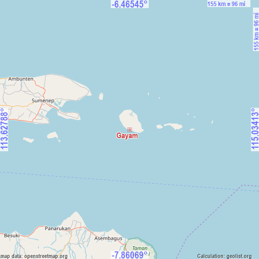
Gayam GPS coordinates[2]
7° 9' 48.96" South, 114° 19' 51.6" East
| Map corner | latitude | longitude |
|---|---|---|
| Upper-left | -6.46545°, | 113.62788° |
| Center: | -7.1636°, | 114.331° |
| Lower-right: | -7.86069°, | 115.03413° |
| Map W x H: | 155.1×155.1 km | = 96.4×96.4mi |
| max Lat: | 5.88969° ⇑43.2% North |
| Gayam: | -7.1636° |
| min Lat: | ⇓56.8% South -10.934° |
| min Long | Gayam | max Long |
| 95.1345° | 114.331° | 140.9419° |
| W 69.2%⇐ | ⇒30.8% E |
Elevation
Elevation of Gayam is 19 m = 62 ft, and this is 210.7 m = 691 ft below average elevation for this country.
| Max E: |
3185 m = 10449 ft | 79.9% |
| Avg. | 229.7 m = 754 ft | |
| Gayam | 19 m = 62 ft | |
Min E: |
-1 m = -3 ft | 20.1% |
See also: Indonesia elevation on elevation.city.
Geographical zone
Gayam is located in South Torrid zone (between Equator and Tropic of Capricorn). Distance of Equator is 796.5 km =494.9 mi to North.| Distance of | km | miles | from Gayam |
|---|---|---|---|
| Equator | 796.5 | 494.9 | to North |
| Tropic Capricorn | 1809.4 | 1124.3 | to South |
| Antarctic Circle | 6604.7 | 4104 | to South |
| South Pole | 9210.5 | 5723.1 | to South |


Nearby cities:
15 places around Gayam: (largest is in red/bold)
• Daleman
8 km =5 mi,  353°
353°
• Guder Lao
2.7 km =1.7 mi, 351°
• Jambuir Timur
1.2 km =0.7 mi,  356°
356°
• Kemuning
7.8 km =4.8 mi,  3°
3°
• Kengkang
3.2 km =2 mi,  23°
23°
• Klebu
4.1 km =2.5 mi,  316°
316°
• Koatas Lao
3.9 km =2.4 mi,  54°
54°
• Nonggunong
10.3 km =6.4 mi,  11°
11°
• Pabungkon Daja
6.9 km =4.3 mi,  82°
82°
• Pocok
8.2 km =5.1 mi,  26°
26°
• Prengbatu
2.5 km =1.6 mi,  35°
35°
• Rokoro
1.4 km =0.9 mi, 77°
• Sokarame
10.2 km =6.3 mi,  330°
330°
• Tanamera
9.7 km =6 mi, 3°
• Tarebung
10.1 km =6.3 mi, 320°
Sources, notices
• [Note1] Compared only with cities in Indonesia existing in our database
• [Src1] Map data: © OpenStreetMap contributors (CC-BY-SA)
• [Src2] Other city data from geonames.org with taken over terms of usage.
• [Src3] Geographical zone / Annual Mean Temperature by Robert A. Rohde @ Wikipedia
