Puntaru geodata
Puntaru (East Nusa Tenggara) is a seat of a fourth-order administrative division; located in Indonesia in Asia/Makassar (GMT+8) time zone. In our database, there are 407 cities with bigger population. Compared to other cities in Indonesia, 81.8% of cities are located further ↑North; 94.5% of cities are located further ←West and 69.5% of cities have higher elevation than Puntaru. Note1


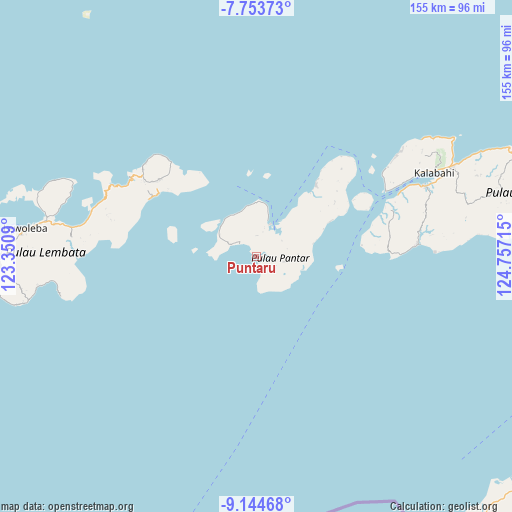
Puntaru GPS coordinates[2]
8° 26' 59.388" South, 124° 3' 14.472" East
| Map corner | latitude | longitude |
|---|---|---|
| Upper-left | -7.75373°, | 123.3509° |
| Center: | -8.44983°, | 124.05402° |
| Lower-right: | -9.14468°, | 124.75715° |
| Map W x H: | 154.7×154.7 km | = 96.1×96.1mi |
| max Lat: | 5.88969° ⇑81.8% North |
| Puntaru: | -8.44983° |
| min Lat: | ⇓18.2% South -10.934° |
| min Long | Puntaru | max Long |
| 95.1345° | 124.05402° | 140.9419° |
| W 94.5%⇐ | ⇒5.5% E |
Elevation
Elevation of Puntaru is 33 m = 108 ft, and this is 196.7 m = 645 ft below average elevation for this country.
| Max E: |
3185 m = 10449 ft | 69.5% |
| Avg. | 229.7 m = 754 ft | |
| Puntaru | 33 m = 108 ft | |
Min E: |
-1 m = -3 ft | 30.5% |
See also: Indonesia elevation on elevation.city.
Geographical zone
Puntaru is located in South Torrid zone (between Equator and Tropic of Capricorn). Distance of Equator is 939.5 km =583.8 mi to North.| Distance of | km | miles | from Puntaru |
|---|---|---|---|
| Equator | 939.5 | 583.8 | to North |
| Tropic Capricorn | 1666.4 | 1035.5 | to South |
| Antarctic Circle | 6461.6 | 4015.1 | to South |
| South Pole | 9067.5 | 5634.3 | to South |


Nearby cities:
15 places around Puntaru: (largest is in red/bold)
• Apuri
37.3 km =23.2 mi,  66°
66°
• Bakalang
33.8 km =21 mi,  52°
52°
• Baranusa
10.5 km =6.5 mi,  21°
21°
• Kabir
28 km =17.4 mi,  39°
39°
• Latuna
6.4 km =4 mi,  1°
1°
• Leudawan
36.8 km =22.9 mi,  314°
314°
• Leutubung Satu
36.5 km =22.7 mi, 312°
• Maliang
11.3 km =7 mi, 48°
• Marica
14.8 km =9.2 mi,  319°
319°
• Mauta
8.6 km =5.3 mi,  99°
99°
• Nuhawala
22 km =13.7 mi, 67°
• Pandai
36.9 km =22.9 mi, 38°
• Roun Satu
36.6 km =22.7 mi, 313°
• Tamalabang
24.8 km =15.4 mi,  64°
64°
• Tobitambor
29.1 km =18.1 mi, 38°
Sources, notices
• [Note1] Compared only with cities in Indonesia existing in our database
• [Src1] Map data: © OpenStreetMap contributors (CC-BY-SA)
• [Src2] Other city data from geonames.org with taken over terms of usage.
• [Src3] Geographical zone / Annual Mean Temperature by Robert A. Rohde @ Wikipedia
