Tapolangu geodata
Tapolangu (East Nusa Tenggara) is a seat of a fourth-order administrative division; located in Indonesia in Asia/Makassar (GMT+8) time zone. In our database, there are 407 cities with bigger population. Compared to other cities in Indonesia, 77% of cities are located further ↑North; 93% of cities are located further ←West and 79.9% of cities have higher elevation than Tapolangu. Note1


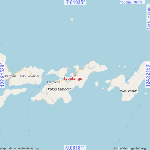
Tapolangu GPS coordinates[2]
8° 18' 24.12" South, 123° 37' 6.24" East
| Map corner | latitude | longitude |
|---|---|---|
| Upper-left | -7.61035°, | 122.91528° |
| Center: | -8.3067°, | 123.6184° |
| Lower-right: | -9.00181°, | 124.32153° |
| Map W x H: | 154.7×154.7 km | = 96.1×96.1mi |
| max Lat: | 5.88969° ⇑77% North |
| Tapolangu: | -8.3067° |
| min Lat: | ⇓23% South -10.934° |
| min Long | Tapolangu | max Long |
| 95.1345° | 123.6184° | 140.9419° |
| W 93%⇐ | ⇒7% E |
Elevation
Elevation of Tapolangu is 19 m = 62 ft, and this is 210.7 m = 691 ft below average elevation for this country.
| Max E: |
3185 m = 10449 ft | 79.9% |
| Avg. | 229.7 m = 754 ft | |
| Tapolangu | 19 m = 62 ft | |
Min E: |
-1 m = -3 ft | 20.1% |
See also: Indonesia elevation on elevation.city.
Geographical zone
Tapolangu is located in South Torrid zone (between Equator and Tropic of Capricorn). Distance of Equator is 923.6 km =573.9 mi to North.| Distance of | km | miles | from Tapolangu |
|---|---|---|---|
| Equator | 923.6 | 573.9 | to North |
| Tropic Capricorn | 1682.3 | 1045.3 | to South |
| Antarctic Circle | 6477.6 | 4025 | to South |
| South Pole | 9083.4 | 5644.2 | to South |


Nearby cities:
15 places around Tapolangu: (largest is in red/bold)
• Balauring
12.6 km =7.8 mi,  49°
49°
• Baopukang
11 km =6.8 mi,  269°
269°
• Ebak
13.3 km =8.3 mi,  304°
304°
• Hadakewa
10.5 km =6.5 mi,  228°
228°
• Kimakamak
13.3 km =8.3 mi,  256°
256°
• Lamawolo
9 km =5.6 mi, 298°
• Lerahinga
9.9 km =6.2 mi, 225°
• Leramatang
8.2 km =5.1 mi,  218°
218°
• Lewodoli
6.1 km =3.8 mi,  139°
139°
• Lewoeleng
3.4 km =2.1 mi,  164°
164°
• Lodobelolong
4.2 km =2.6 mi, 140°
• Merdeka
12 km =7.5 mi,  236°
236°
• Nilanapo
11.8 km =7.3 mi,  101°
101°
• Tokojaeng
9.6 km =6 mi, 304°
• Wailolong
7.3 km =4.5 mi,  39°
39°
Sources, notices
• [Note1] Compared only with cities in Indonesia existing in our database
• [Src1] Map data: © OpenStreetMap contributors (CC-BY-SA)
• [Src2] Other city data from geonames.org with taken over terms of usage.
• [Src3] Geographical zone / Annual Mean Temperature by Robert A. Rohde @ Wikipedia
