Tokojaeng geodata
Tokojaeng (East Nusa Tenggara) is a seat of a fourth-order administrative division; located in Indonesia in Asia/Makassar (GMT+8) time zone. In our database, there are 407 cities with bigger population. Compared to other cities in Indonesia, 74.6% of cities are located further ↑North; 92.6% of cities are located further ←West and 84.2% of cities have higher elevation than Tokojaeng. Note1


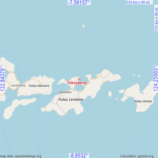
Tokojaeng GPS coordinates[2]
8° 15' 28.8" South, 123° 32' 48.84" East
| Map corner | latitude | longitude |
|---|---|---|
| Upper-left | -7.56157°, | 122.84378° |
| Center: | -8.258°, | 123.5469° |
| Lower-right: | -8.9532°, | 124.25003° |
| Map W x H: | 154.7×154.7 km | = 96.1×96.1mi |
| max Lat: | 5.88969° ⇑74.6% North |
| Tokojaeng: | -8.258° |
| min Lat: | ⇓25.4% South -10.934° |
| min Long | Tokojaeng | max Long |
| 95.1345° | 123.5469° | 140.9419° |
| W 92.6%⇐ | ⇒7.4% E |
Elevation
Elevation of Tokojaeng is 15 m = 49 ft, and this is 214.7 m = 704 ft below average elevation for this country.
| Max E: |
3185 m = 10449 ft | 84.2% |
| Avg. | 229.7 m = 754 ft | |
| Tokojaeng | 15 m = 49 ft | |
Min E: |
-1 m = -3 ft | 15.8% |
See also: Indonesia elevation on elevation.city.
Geographical zone
Tokojaeng is located in South Torrid zone (between Equator and Tropic of Capricorn). Distance of Equator is 918.2 km =570.5 mi to North.| Distance of | km | miles | from Tokojaeng |
|---|---|---|---|
| Equator | 918.2 | 570.5 | to North |
| Tropic Capricorn | 1687.7 | 1048.7 | to South |
| Antarctic Circle | 6483 | 4028.3 | to South |
| South Pole | 9088.9 | 5647.6 | to South |


Nearby cities:
15 places around Tokojaeng: (largest is in red/bold)
• Atawutung
6 km =3.7 mi,  285°
285°
• Baopukang
6.4 km =4 mi,  209°
209°
• Dualein
9.6 km =6 mi,  261°
261°
• Ebak
3.7 km =2.3 mi,  306°
306°
• Kimakamak
9.9 km =6.2 mi, 210°
• Lamawolo
1.1 km =0.7 mi,  179°
179°
• Lewotolok
8.6 km =5.3 mi,  265°
265°
• Mawa
6.8 km =4.2 mi,  281°
281°
• Muruona
11.1 km =6.9 mi,  224°
224°
• Ohe
11.6 km =7.2 mi,  237°
237°
• Riangbao
11.5 km =7.1 mi,  245°
245°
• Tanjungbatu
9 km =5.6 mi, 262°
• Tapolangu
9.6 km =6 mi,  124°
124°
• Waipukang
11.5 km =7.1 mi,  232°
232°
• Watomean
7.7 km =4.8 mi, 273°
Sources, notices
• [Note1] Compared only with cities in Indonesia existing in our database
• [Src1] Map data: © OpenStreetMap contributors (CC-BY-SA)
• [Src2] Other city data from geonames.org with taken over terms of usage.
• [Src3] Geographical zone / Annual Mean Temperature by Robert A. Rohde @ Wikipedia
