Riangwale geodata
Riangwale (East Nusa Tenggara) is a seat of a fourth-order administrative division; located in Indonesia in Asia/Makassar (GMT+8) time zone. In our database, there are 407 cities with bigger population. Compared to other cities in Indonesia, 79.9% of cities are located further ↑North; 91.4% of cities are located further ←West and 50% of cities have lower elevation than Riangwale. Note1


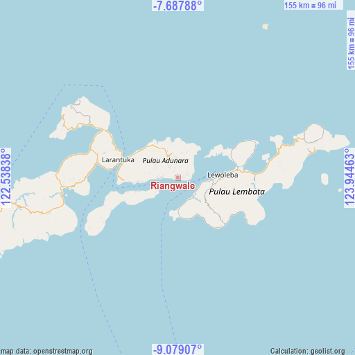
Riangwale GPS coordinates[2]
8° 23' 2.76" South, 123° 14' 29.4" East
| Map corner | latitude | longitude |
|---|---|---|
| Upper-left | -7.68788°, | 122.53838° |
| Center: | -8.3841°, | 123.2415° |
| Lower-right: | -9.07907°, | 123.94463° |
| Map W x H: | 154.7×154.7 km | = 96.1×96.1mi |
| max Lat: | 5.88969° ⇑79.9% North |
| Riangwale: | -8.3841° |
| min Lat: | ⇓20.1% South -10.934° |
| min Long | Riangwale | max Long |
| 95.1345° | 123.2415° | 140.9419° |
| W 91.4%⇐ | ⇒8.6% E |
Elevation
Elevation of Riangwale is 102 m = 335 ft, and this is 127.7 m = 419 ft below average elevation for this country.
| Max E: |
3185 m = 10449 ft | 50% |
| Avg. | 229.7 m = 754 ft | |
| Riangwale | 102 m = 335 ft | |
Min E: |
-1 m = -3 ft | 50% |
See also: Indonesia elevation on elevation.city.
Geographical zone
Riangwale is located in South Torrid zone (between Equator and Tropic of Capricorn). Distance of Equator is 932.2 km =579.2 mi to North.| Distance of | km | miles | from Riangwale |
|---|---|---|---|
| Equator | 932.2 | 579.2 | to North |
| Tropic Capricorn | 1673.7 | 1040 | to South |
| Antarctic Circle | 6468.9 | 4019.6 | to South |
| South Pole | 9074.8 | 5638.8 | to South |


Nearby cities:
15 places around Riangwale: (largest is in red/bold)
• Boleng
5.9 km =3.7 mi,  88°
88°
• Gayak
6 km =3.7 mi,  82°
82°
• Kuyalewun
0.9 km =0.6 mi,  354°
354°
• Lamalouk
5.8 km =3.6 mi,  328°
328°
• Lamawolo
0.9 km =0.6 mi,  102°
102°
• Lewoduli
3.8 km =2.4 mi, 333°
• Lewolen
5.3 km =3.3 mi,  320°
320°
• Lewopao
2.7 km =1.7 mi, 85°
• Lidang A
1.9 km =1.2 mi, 76°
• Nihaona
1.2 km =0.7 mi,  343°
343°
• Ongabelen
7 km =4.3 mi, 321°
• Pukaona B
4.4 km =2.7 mi,  70°
70°
• Riangwerang
6.3 km =3.9 mi, 317°
• Senadan
1.8 km =1.1 mi, 94°
• Wakapuken
6.1 km =3.8 mi, 319°
Sources, notices
• [Note1] Compared only with cities in Indonesia existing in our database
• [Src1] Map data: © OpenStreetMap contributors (CC-BY-SA)
• [Src2] Other city data from geonames.org with taken over terms of usage.
• [Src3] Geographical zone / Annual Mean Temperature by Robert A. Rohde @ Wikipedia
