Riangwerang geodata
Riangwerang (East Nusa Tenggara) is a seat of a fourth-order administrative division; located in Indonesia in Asia/Makassar (GMT+8) time zone. In our database, there are 407 cities with bigger population. Compared to other cities in Indonesia, 78.5% of cities are located further ↑North; 91.1% of cities are located further ←West and 73.5% of cities have lower elevation than Riangwerang. Note1


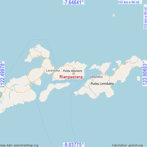
Riangwerang GPS coordinates[2]
8° 20' 33.72" South, 123° 12' 10.44" East
| Map corner | latitude | longitude |
|---|---|---|
| Upper-left | -7.64641°, | 122.49978° |
| Center: | -8.3427°, | 123.2029° |
| Lower-right: | -9.03775°, | 123.90603° |
| Map W x H: | 154.7×154.7 km | = 96.1×96.1mi |
| max Lat: | 5.88969° ⇑78.5% North |
| Riangwerang: | -8.3427° |
| min Lat: | ⇓21.5% South -10.934° |
| min Long | Riangwerang | max Long |
| 95.1345° | 123.2029° | 140.9419° |
| W 91.1%⇐ | ⇒8.9% E |
Elevation
Elevation of Riangwerang is 340 m = 1115 ft, and this is 110.3 m = 362 ft above average elevation for this country.
| Max E: |
3185 m = 10449 ft | 26.5% |
| Riangwerang | 340 m 1115 ft | |
| Avg. | 229.7 m = 754 ft | |
Min E: |
-1 m = -3 ft | 73.5% |
See also: Indonesia elevation on elevation.city.
Geographical zone
Riangwerang is located in South Torrid zone (between Equator and Tropic of Capricorn). Distance of Equator is 927.6 km =576.4 mi to North.| Distance of | km | miles | from Riangwerang |
|---|---|---|---|
| Equator | 927.6 | 576.4 | to North |
| Tropic Capricorn | 1678.3 | 1042.8 | to South |
| Antarctic Circle | 6473.6 | 4022.5 | to South |
| South Pole | 9079.4 | 5641.7 | to South |


Nearby cities:
15 places around Riangwerang: (largest is in red/bold)
• Hinga
4.8 km =3 mi,  36°
36°
• Horowura
3.6 km =2.2 mi,  32°
32°
• Ladoang
5.3 km =3.3 mi,  6°
6°
• Lamalouk
1.2 km =0.7 mi,  76°
76°
• Lamaluwo
5.4 km =3.4 mi,  269°
269°
• Lewobelek
4.6 km =2.9 mi, 38°
• Lewoduli
2.8 km =1.7 mi,  116°
116°
• Lewolen
1 km =0.6 mi, 122°
• Lewonara
3.7 km =2.3 mi,  245°
245°
• Lewotukan
3.9 km =2.4 mi,  49°
49°
• Nihaona
5.2 km =3.2 mi,  131°
131°
• Ongabelen
0.9 km =0.6 mi,  350°
350°
• Wainira
4.9 km =3 mi, 349°
• Wakapuken
0.3 km =0.2 mi,  87°
87°
• Wuaona
5.5 km =3.4 mi, 39°
Sources, notices
• [Note1] Compared only with cities in Indonesia existing in our database
• [Src1] Map data: © OpenStreetMap contributors (CC-BY-SA)
• [Src2] Other city data from geonames.org with taken over terms of usage.
• [Src3] Geographical zone / Annual Mean Temperature by Robert A. Rohde @ Wikipedia
