Tanuwore geodata
Tanuwore (East Nusa Tenggara) is a seat of a fourth-order administrative division; located in Indonesia in Asia/Makassar (GMT+8) time zone. In our database, there are 407 cities with bigger population. Compared to other cities in Indonesia, 75.7% of cities are located further ↑North; 91.1% of cities are located further ←West and 75.9% of cities have lower elevation than Tanuwore. Note1


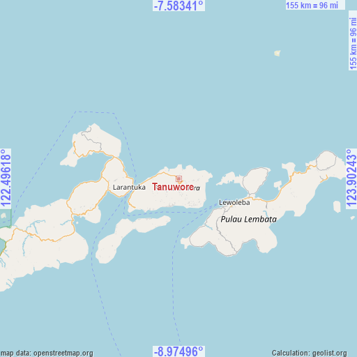
Tanuwore GPS coordinates[2]
8° 16' 47.28" South, 123° 11' 57.48" East
| Map corner | latitude | longitude |
|---|---|---|
| Upper-left | -7.58341°, | 122.49618° |
| Center: | -8.2798°, | 123.1993° |
| Lower-right: | -8.97496°, | 123.90243° |
| Map W x H: | 154.7×154.7 km | = 96.1×96.1mi |
| max Lat: | 5.88969° ⇑75.7% North |
| Tanuwore: | -8.2798° |
| min Lat: | ⇓24.3% South -10.934° |
| min Long | Tanuwore | max Long |
| 95.1345° | 123.1993° | 140.9419° |
| W 91.1%⇐ | ⇒8.9% E |
Elevation
Elevation of Tanuwore is 370 m = 1214 ft, and this is 140.3 m = 460 ft above average elevation for this country.
| Max E: |
3185 m = 10449 ft | 24.1% |
| Tanuwore | 370 m 1214 ft | |
| Avg. | 229.7 m = 754 ft | |
Min E: |
-1 m = -3 ft | 75.9% |
See also: Indonesia elevation on elevation.city.
Geographical zone
Tanuwore is located in South Torrid zone (between Equator and Tropic of Capricorn). Distance of Equator is 920.6 km =572 mi to North.| Distance of | km | miles | from Tanuwore |
|---|---|---|---|
| Equator | 920.6 | 572 | to North |
| Tropic Capricorn | 1685.3 | 1047.2 | to South |
| Antarctic Circle | 6480.5 | 4026.8 | to South |
| South Pole | 9086.4 | 5646 | to South |


Nearby cities:
15 places around Tanuwore: (largest is in red/bold)
• Hinga
4.6 km =2.9 mi,  134°
134°
• Horowura
4.6 km =2.9 mi,  150°
150°
• Kampungsusah
5 km =3.1 mi,  124°
124°
• Kereta
2.8 km =1.7 mi,  110°
110°
• Klubagolit
3.8 km =2.4 mi, 122°
• Kolibali
5.6 km =3.5 mi,  100°
100°
• Ladoang
2 km =1.2 mi, 149°
• Lewobelek
4.7 km =2.9 mi,  136°
136°
• Lewotukan
5.6 km =3.5 mi, 142°
• Lowotukan
1.5 km =0.9 mi,  192°
192°
• Narawayong
4.5 km =2.8 mi, 105°
• Papilawe
5.8 km =3.6 mi,  226°
226°
• Wainira
2.3 km =1.4 mi, 191°
• Wewit
5.2 km =3.2 mi,  242°
242°
• Wuaona
4.8 km =3 mi, 124°
Sources, notices
• [Note1] Compared only with cities in Indonesia existing in our database
• [Src1] Map data: © OpenStreetMap contributors (CC-BY-SA)
• [Src2] Other city data from geonames.org with taken over terms of usage.
• [Src3] Geographical zone / Annual Mean Temperature by Robert A. Rohde @ Wikipedia
