Lowotukan geodata
Lowotukan (East Nusa Tenggara) is a seat of a fourth-order administrative division; located in Indonesia in Asia/Makassar (GMT+8) time zone. In our database, there are 407 cities with bigger population. Compared to other cities in Indonesia, 76.4% of cities are located further ↑North; 91.1% of cities are located further ←West and 81.1% of cities have lower elevation than Lowotukan. Note1


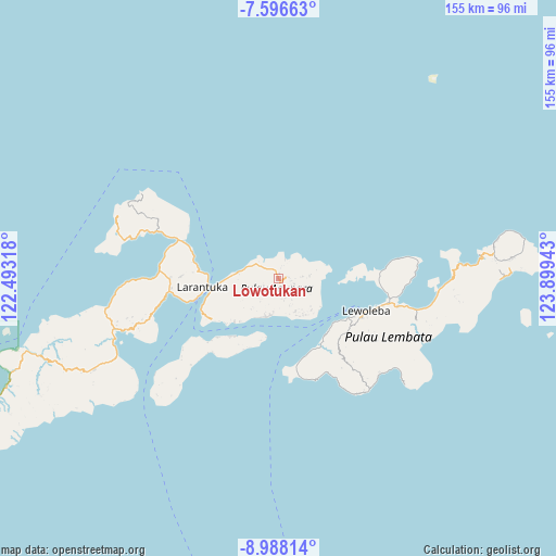
Lowotukan GPS coordinates[2]
8° 17' 34.8" South, 123° 11' 46.68" East
| Map corner | latitude | longitude |
|---|---|---|
| Upper-left | -7.59663°, | 122.49318° |
| Center: | -8.293°, | 123.1963° |
| Lower-right: | -8.98814°, | 123.89943° |
| Map W x H: | 154.7×154.7 km | = 96.1×96.1mi |
| max Lat: | 5.88969° ⇑76.4% North |
| Lowotukan: | -8.293° |
| min Lat: | ⇓23.6% South -10.934° |
| min Long | Lowotukan | max Long |
| 95.1345° | 123.1963° | 140.9419° |
| W 91.1%⇐ | ⇒8.9% E |
Elevation
Elevation of Lowotukan is 449 m = 1473 ft, and this is 219.3 m = 719 ft above average elevation for this country.
| Max E: |
3185 m = 10449 ft | 18.9% |
| Lowotukan | 449 m 1473 ft | |
| Avg. | 229.7 m = 754 ft | |
Min E: |
-1 m = -3 ft | 81.1% |
See also: Indonesia elevation on elevation.city.
Geographical zone
Lowotukan is located in South Torrid zone (between Equator and Tropic of Capricorn). Distance of Equator is 922.1 km =573 mi to North.| Distance of | km | miles | from Lowotukan |
|---|---|---|---|
| Equator | 922.1 | 573 | to North |
| Tropic Capricorn | 1683.8 | 1046.3 | to South |
| Antarctic Circle | 6479.1 | 4025.9 | to South |
| South Pole | 9085 | 5645.2 | to South |


Nearby cities:
15 places around Lowotukan: (largest is in red/bold)
• Hinga
4 km =2.5 mi,  115°
115°
• Horowura
3.6 km =2.2 mi,  133°
133°
• Kampungsusah
4.7 km =2.9 mi,  106°
106°
• Kereta
3 km =1.9 mi,  81°
81°
• Klubagolit
3.6 km =2.2 mi,  98°
98°
• Ladoang
1.4 km =0.9 mi, 102°
• Lewobelek
4.1 km =2.5 mi, 118°
• Lewotukan
4.7 km =2.9 mi, 128°
• Narawayong
4.7 km =2.9 mi,  87°
87°
• Ongabelen
4.7 km =2.9 mi,  172°
172°
• Papilawe
4.6 km =2.9 mi,  237°
237°
• Tanuwore
1.5 km =0.9 mi,  12°
12°
• Wainira
0.8 km =0.5 mi,  190°
190°
• Wewit
4.4 km =2.7 mi,  257°
257°
• Wuaona
4.4 km =2.7 mi, 106°
Sources, notices
• [Note1] Compared only with cities in Indonesia existing in our database
• [Src1] Map data: © OpenStreetMap contributors (CC-BY-SA)
• [Src2] Other city data from geonames.org with taken over terms of usage.
• [Src3] Geographical zone / Annual Mean Temperature by Robert A. Rohde @ Wikipedia
