Wewit geodata
Wewit (East Nusa Tenggara) is a seat of a fourth-order administrative division; located in Indonesia in Asia/Makassar (GMT+8) time zone. In our database, there are 407 cities with bigger population. Compared to other cities in Indonesia, 76.8% of cities are located further ↑North; 90.9% of cities are located further ←West and 86% of cities have lower elevation than Wewit. Note1


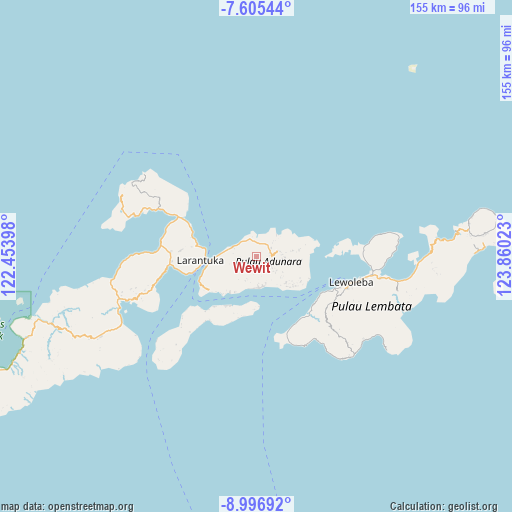
Wewit GPS coordinates[2]
8° 18' 6.48" South, 123° 9' 25.56" East
| Map corner | latitude | longitude |
|---|---|---|
| Upper-left | -7.60544°, | 122.45398° |
| Center: | -8.3018°, | 123.1571° |
| Lower-right: | -8.99692°, | 123.86023° |
| Map W x H: | 154.7×154.7 km | = 96.1×96.1mi |
| max Lat: | 5.88969° ⇑76.8% North |
| Wewit: | -8.3018° |
| min Lat: | ⇓23.2% South -10.934° |
| min Long | Wewit | max Long |
| 95.1345° | 123.1571° | 140.9419° |
| W 90.9%⇐ | ⇒9.1% E |
Elevation
Elevation of Wewit is 536 m = 1759 ft, and this is 306.3 m = 1005 ft above average elevation for this country.
| Max E: |
3185 m = 10449 ft | 14% |
| Wewit | 536 m 1759 ft | |
| Avg. | 229.7 m = 754 ft | |
Min E: |
-1 m = -3 ft | 86% |
See also: Indonesia elevation on elevation.city.
Geographical zone
Wewit is located in South Torrid zone (between Equator and Tropic of Capricorn). Distance of Equator is 923.1 km =573.6 mi to North.| Distance of | km | miles | from Wewit |
|---|---|---|---|
| Equator | 923.1 | 573.6 | to North |
| Tropic Capricorn | 1682.8 | 1045.6 | to South |
| Antarctic Circle | 6478.1 | 4025.3 | to South |
| South Pole | 9084 | 5644.5 | to South |


Nearby cities:
15 places around Wewit: (largest is in red/bold)
• Bayuwan
2.7 km =1.7 mi,  219°
219°
• Era
5.8 km =3.6 mi,  241°
241°
• Ladoang
5.7 km =3.5 mi,  83°
83°
• Lamaluwo
4.6 km =2.9 mi,  183°
183°
• Leter
4.6 km =2.9 mi, 242°
• Lowotukan
4.4 km =2.7 mi, 77°
• Mulawato
2.8 km =1.7 mi,  195°
195°
• Ongabelen
6.1 km =3.8 mi,  126°
126°
• Papilawe
1.6 km =1 mi,  164°
164°
• Riangpao
3.3 km =2.1 mi,  190°
190°
• Tanahpukang
1.8 km =1.1 mi,  206°
206°
• Tanuwore
5.2 km =3.2 mi,  62°
62°
• Waibereno
1.7 km =1.1 mi,  254°
254°
• Wainira
4.2 km =2.6 mi,  86°
86°
• Waitenepang
6.1 km =3.8 mi,  303°
303°
Sources, notices
• [Note1] Compared only with cities in Indonesia existing in our database
• [Src1] Map data: © OpenStreetMap contributors (CC-BY-SA)
• [Src2] Other city data from geonames.org with taken over terms of usage.
• [Src3] Geographical zone / Annual Mean Temperature by Robert A. Rohde @ Wikipedia
