Lemboleng geodata
Lemboleng (East Nusa Tenggara) is a seat of a fourth-order administrative division; located in Indonesia in Asia/Makassar (GMT+8) time zone. In our database, there are 407 cities with bigger population. Compared to other cities in Indonesia, 82.9% of cities are located further ↑North; 90.6% of cities are located further ←West and 74.1% of cities have higher elevation than Lemboleng. Note1


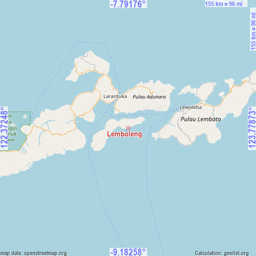
Lemboleng GPS coordinates[2]
8° 29' 16.08" South, 123° 4' 32.16" East
| Map corner | latitude | longitude |
|---|---|---|
| Upper-left | -7.79176°, | 122.37248° |
| Center: | -8.4878°, | 123.0756° |
| Lower-right: | -9.18258°, | 123.77873° |
| Map W x H: | 154.6×154.6 km | = 96.1×96.1mi |
| max Lat: | 5.88969° ⇑82.9% North |
| Lemboleng: | -8.4878° |
| min Lat: | ⇓17.1% South -10.934° |
| min Long | Lemboleng | max Long |
| 95.1345° | 123.0756° | 140.9419° |
| W 90.6%⇐ | ⇒9.4% E |
Elevation
Elevation of Lemboleng is 26 m = 85 ft, and this is 203.7 m = 668 ft below average elevation for this country.
| Max E: |
3185 m = 10449 ft | 74.1% |
| Avg. | 229.7 m = 754 ft | |
| Lemboleng | 26 m = 85 ft | |
Min E: |
-1 m = -3 ft | 25.9% |
See also: Indonesia elevation on elevation.city.
Geographical zone
Lemboleng is located in South Torrid zone (between Equator and Tropic of Capricorn). Distance of Equator is 943.8 km =586.4 mi to North.| Distance of | km | miles | from Lemboleng |
|---|---|---|---|
| Equator | 943.8 | 586.4 | to North |
| Tropic Capricorn | 1662.2 | 1032.8 | to South |
| Antarctic Circle | 6457.4 | 4012.4 | to South |
| South Pole | 9063.3 | 5631.7 | to South |


Nearby cities:
15 places around Lemboleng: (largest is in red/bold)
• Baniona
9.8 km =6.1 mi,  5°
5°
• Gorang
8.9 km =5.5 mi,  43°
43°
• Haridimun
8.2 km =5.1 mi,  266°
266°
• Karawatung
7.6 km =4.7 mi,  301°
301°
• Klukeng
10.2 km =6.3 mi, 6°
• Lamagohang
6.6 km =4.1 mi,  277°
277°
• Lamawai
4 km =2.5 mi,  60°
60°
• Lewograran
5.2 km =3.2 mi, 284°
• Lohayong
6 km =3.7 mi,  352°
352°
• Menanga
5.9 km =3.7 mi, 12°
• Mewet
10.1 km =6.3 mi, 14°
• Ongalereng
8.8 km =5.5 mi, 302°
• Waiwukak
9 km =5.6 mi, 352°
• Watoona
1.9 km =1.2 mi, 59°
• Wulublolong
6.6 km =4.1 mi,  325°
325°
Sources, notices
• [Note1] Compared only with cities in Indonesia existing in our database
• [Src1] Map data: © OpenStreetMap contributors (CC-BY-SA)
• [Src2] Other city data from geonames.org with taken over terms of usage.
• [Src3] Geographical zone / Annual Mean Temperature by Robert A. Rohde @ Wikipedia
