Kaliuda geodata
Kaliuda (East Nusa Tenggara) is a seat of a fourth-order administrative division; located in Indonesia in Asia/Makassar (GMT+8) time zone. In our database, there are 407 cities with bigger population. Compared to other cities in Indonesia, 97.7% of cities are located further ↑North; 85% of cities are located further ←West and 76.2% of cities have higher elevation than Kaliuda. Note1


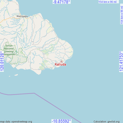
Kaliuda GPS coordinates[2]
10° 9' 52.56" South, 120° 42' 51.84" East
| Map corner | latitude | longitude |
|---|---|---|
| Upper-left | -9.47178°, | 120.01128° |
| Center: | -10.1646°, | 120.7144° |
| Lower-right: | -10.85592°, | 121.41753° |
| Map W x H: | 153.9×153.9 km | = 95.6×95.6mi |
| max Lat: | 5.88969° ⇑97.7% North |
| Kaliuda: | -10.1646° |
| min Lat: | ⇓2.3% South -10.934° |
| min Long | Kaliuda | max Long |
| 95.1345° | 120.7144° | 140.9419° |
| W 85%⇐ | ⇒15% E |
Elevation
Elevation of Kaliuda is 23 m = 75 ft, and this is 206.7 m = 678 ft below average elevation for this country.
| Max E: |
3185 m = 10449 ft | 76.2% |
| Avg. | 229.7 m = 754 ft | |
| Kaliuda | 23 m = 75 ft | |
Min E: |
-1 m = -3 ft | 23.8% |
See also: Indonesia elevation on elevation.city.
Geographical zone
Kaliuda is located in South Torrid zone (between Equator and Tropic of Capricorn). Distance of Equator is 1130.2 km =702.3 mi to North.| Distance of | km | miles | from Kaliuda |
|---|---|---|---|
| Equator | 1130.2 | 702.3 | to North |
| Tropic Capricorn | 1475.7 | 917 | to South |
| Antarctic Circle | 6271 | 3896.6 | to South |
| South Pole | 8876.9 | 5515.8 | to South |


Nearby cities:
15 places around Kaliuda: (largest is in red/bold)
• Baing
18.1 km =11.2 mi,  249°
249°
• Kalumbang
31.6 km =19.6 mi,  347°
347°
• Maumaru
29.7 km =18.5 mi,  307°
307°
• Mbulung
20.2 km =12.6 mi, 250°
• Mburukullu
10.7 km =6.6 mi,  25°
25°
• Ngalu
2.2 km =1.4 mi,  342°
342°
• Pahenya
20.2 km =12.6 mi,  257°
257°
• Palamadu
14.6 km =9.1 mi,  17°
17°
• Praimarada
32 km =19.9 mi, 341°
• Praiyawang
25.9 km =16.1 mi, 349°
• Ratilangi
2.6 km =1.6 mi,  10°
10°
• Tangguhang
9.6 km =6 mi,  277°
277°
• Umakadambung
17.7 km =11 mi, 252°
• Umanggudang
28.1 km =17.5 mi,  296°
296°
• Walakeri
20.8 km =12.9 mi, 257°
Sources, notices
• [Note1] Compared only with cities in Indonesia existing in our database
• [Src1] Map data: © OpenStreetMap contributors (CC-BY-SA)
• [Src2] Other city data from geonames.org with taken over terms of usage.
• [Src3] Geographical zone / Annual Mean Temperature by Robert A. Rohde @ Wikipedia
