Keumala geodata
Keumala (Aceh) is a seat of a third-order administrative division; located in Indonesia in Asia/Jakarta (GMT+7) time zone. In our database, there are 407 cities with bigger population. Compared to other cities in Indonesia, 99.7% of cities are located further ↓South; 99.7% of cities are located further →East and 66.8% of cities have higher elevation than Keumala. Note1


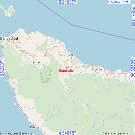
Keumala GPS coordinates[2]
5° 14' 57.48" North, 95° 55' 25.752" East
| Map corner | latitude | longitude |
|---|---|---|
| Upper-left | 5.94907°, | 95.2207° |
| Center: | 5.2493°, | 95.92382° |
| Lower-right: | 4.54875°, | 96.62695° |
| Map W x H: | 155.7×155.7 km | = 96.7×96.7mi |
| max Lat: | 5.88969° ⇑0.3% North |
| Keumala: | 5.2493° |
| min Lat: | ⇓99.7% South -10.934° |
| min Long | Keumala | max Long |
| 95.1345° | 95.92382° | 140.9419° |
| W 0.3%⇐ | ⇒99.7% E |
Elevation
Elevation of Keumala is 38 m = 125 ft, and this is 191.7 m = 629 ft below average elevation for this country.
| Max E: |
3185 m = 10449 ft | 66.8% |
| Avg. | 229.7 m = 754 ft | |
| Keumala | 38 m = 125 ft | |
Min E: |
-1 m = -3 ft | 33.2% |
See also: Indonesia elevation on elevation.city.
Geographical zone
Keumala is located in North Torrid zone (between Equator and Tropic of Cancer). Distance of Equator is 583.7 km =362.7 mi to South.| Distance of | km | miles | from Keumala |
|---|---|---|---|
| North Pole | 9423.4 | 5855.4 | to North |
| Arctic Circle | 6817.5 | 4236.2 | to North |
| Tropic Cancer | 2022.3 | 1256.6 | to North |
| Equator | 583.7 | 362.7 | to South |


Nearby cities:
15 places around Keumala: (largest is in red/bold)
• Asan Kumbang
13 km =8.1 mi,  61°
61°
• Caloue
8.9 km =5.5 mi,  35°
35°
• Geuleumpangminyeuk
11.7 km =7.3 mi,  89°
89°
• Lampoih
10.3 km =6.4 mi, 42°
• Laweueng
30.8 km =19.1 mi,  343°
343°
• Lueng Putu
14.7 km =9.1 mi, 86°
• Mane
35.8 km =22.2 mi,  165°
165°
• Padangtiji
16.4 km =10.2 mi,  327°
327°
• Pante Raja
24.6 km =15.3 mi, 91°
• Reuleuet
40 km =24.9 mi,  95°
95°
• Seulimeum
40.4 km =25.1 mi,  288°
288°
• Sigli
15.6 km =9.7 mi,  15°
15°
• Tangse
26.2 km =16.3 mi,  182°
182°
• Tiro
6.5 km =4 mi, 167°
• Trienggadeng
30.8 km =19.1 mi, 91°
Sources, notices
• [Note1] Compared only with cities in Indonesia existing in our database
• [Src1] Map data: © OpenStreetMap contributors (CC-BY-SA)
• [Src2] Other city data from geonames.org with taken over terms of usage.
• [Src3] Geographical zone / Annual Mean Temperature by Robert A. Rohde @ Wikipedia
