Lampoih geodata
Lampoih (Aceh) is a seat of a third-order administrative division; located in Indonesia in Asia/Jakarta (GMT+7) time zone. In our database, there are 407 cities with bigger population. Compared to other cities in Indonesia, 99.8% of cities are located further ↓South; 99.7% of cities are located further →East and 92.1% of cities have higher elevation than Lampoih. Note1


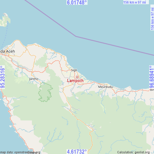
Lampoih GPS coordinates[2]
5° 19' 4.08" North, 95° 59' 10.608" East
| Map corner | latitude | longitude |
|---|---|---|
| Upper-left | 6.01748°, | 95.28316° |
| Center: | 5.3178°, | 95.98628° |
| Lower-right: | 4.61732°, | 96.68941° |
| Map W x H: | 155.7×155.7 km | = 96.7×96.7mi |
| max Lat: | 5.88969° ⇑0.2% North |
| Lampoih: | 5.3178° |
| min Lat: | ⇓99.8% South -10.934° |
| min Long | Lampoih | max Long |
| 95.1345° | 95.98628° | 140.9419° |
| W 0.3%⇐ | ⇒99.7% E |
Elevation
Elevation of Lampoih is 9 m = 30 ft, and this is 220.7 m = 724 ft below average elevation for this country.
| Max E: |
3185 m = 10449 ft | 92.1% |
| Avg. | 229.7 m = 754 ft | |
| Lampoih | 9 m = 30 ft | |
Min E: |
-1 m = -3 ft | 7.9% |
See also: Indonesia elevation on elevation.city.
Geographical zone
Lampoih is located in North Torrid zone (between Equator and Tropic of Cancer). Distance of Equator is 591.3 km =367.4 mi to South.| Distance of | km | miles | from Lampoih |
|---|---|---|---|
| North Pole | 9415.8 | 5850.7 | to North |
| Arctic Circle | 6809.9 | 4231.5 | to North |
| Tropic Cancer | 2014.6 | 1251.8 | to North |
| Equator | 591.3 | 367.4 | to South |


Nearby cities:
15 places around Lampoih: (largest is in red/bold)
• Asan Kumbang
4.8 km =3 mi,  108°
108°
• Caloue
1.8 km =1.1 mi,  259°
259°
• Geuleumpangminyeuk
8.9 km =5.5 mi,  147°
147°
• Keumala
10.3 km =6.4 mi,  222°
222°
• Laweueng
26.8 km =16.7 mi,  324°
324°
• Lueng Putu
10.3 km =6.4 mi,  130°
130°
• Mane
42.3 km =26.3 mi,  176°
176°
• Padangtiji
16.9 km =10.5 mi,  291°
291°
• Pante Raja
19.5 km =12.1 mi, 114°
• Reuleuet
34.8 km =21.6 mi, 108°
• Sigli
8 km =5 mi,  339°
339°
• Tangse
34.7 km =21.6 mi,  193°
193°
• Tiro
15 km =9.3 mi,  201°
201°
• Trienggadeng
25.4 km =15.8 mi, 109°
• Ulee Gle
39.8 km =24.7 mi, 108°
Sources, notices
• [Note1] Compared only with cities in Indonesia existing in our database
• [Src1] Map data: © OpenStreetMap contributors (CC-BY-SA)
• [Src2] Other city data from geonames.org with taken over terms of usage.
• [Src3] Geographical zone / Annual Mean Temperature by Robert A. Rohde @ Wikipedia
