Ujungbarang Satu geodata
Ujungbarang Satu (Central Java) is a seat of a fourth-order administrative division; located in Indonesia in Asia/Jakarta (GMT+7) time zone. In our database, there are 407 cities with bigger population. Compared to other cities in Indonesia, 54.1% of cities are located further ↓South; 67.9% of cities are located further →East and 81% of cities have lower elevation than Ujungbarang Satu. Note1


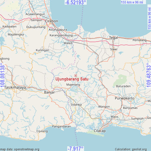
Ujungbarang Satu GPS coordinates[2]
7° 13' 12" South, 108° 47' 4.2" East
| Map corner | latitude | longitude |
|---|---|---|
| Upper-left | -6.52193°, | 108.08138° |
| Center: | -7.22°, | 108.7845° |
| Lower-right: | -7.917°, | 109.48763° |
| Map W x H: | 155.1×155.1 km | = 96.4×96.4mi |
| max Lat: | 5.88969° ⇑45.9% North |
| Ujungbarang Satu: | -7.22° |
| min Lat: | ⇓54.1% South -10.934° |
| min Long | Ujungbarang Sat | max Long |
| 95.1345° | 108.7845° | 140.9419° |
| W 32.1%⇐ | ⇒67.9% E |
Elevation
Elevation of Ujungbarang Satu is 448 m = 1470 ft, and this is 218.3 m = 716 ft above average elevation for this country.
| Max E: |
3185 m = 10449 ft | 19% |
| Ujungbarang Satu | 448 m 1470 ft | |
| Avg. | 229.7 m = 754 ft | |
Min E: |
-1 m = -3 ft | 81% |
See also: Indonesia elevation on elevation.city.
Geographical zone
Ujungbarang Satu is located in South Torrid zone (between Equator and Tropic of Capricorn). Distance of Equator is 802.8 km =498.8 mi to North.| Distance of | km | miles | from Ujungbarang Satu |
|---|---|---|---|
| Equator | 802.8 | 498.8 | to North |
| Tropic Capricorn | 1803.1 | 1120.4 | to South |
| Antarctic Circle | 6598.4 | 4100.1 | to South |
| South Pole | 9204.3 | 5719.3 | to South |


Nearby cities:
15 places around Ujungbarang Satu: (largest is in red/bold)
• Balekambang
2.4 km =1.5 mi,  236°
236°
• Banjaran
3.6 km =2.2 mi,  23°
23°
• Cipasang
6.3 km =3.9 mi,  207°
207°
• Cipeusing
6 km =3.7 mi,  150°
150°
• Gunungjaya
6.2 km =3.9 mi,  310°
310°
• Gununglarang
5.7 km =3.5 mi,  63°
63°
• Indrajaya Satu
5.1 km =3.2 mi,  348°
348°
• Legok
5 km =3.1 mi,  86°
86°
• Legoknyenang
7.1 km =4.4 mi,  44°
44°
• Sadabumi
3.8 km =2.4 mi,  280°
280°
• Sadahayu
7.1 km =4.4 mi,  274°
274°
• Salem
4.8 km =3 mi,  29°
29°
• Salem Kidul
4.4 km =2.7 mi, 29°
• Sindangjati
5.2 km =3.2 mi, 239°
• Walahir
3.8 km =2.4 mi,  181°
181°
Sources, notices
• [Note1] Compared only with cities in Indonesia existing in our database
• [Src1] Map data: © OpenStreetMap contributors (CC-BY-SA)
• [Src2] Other city data from geonames.org with taken over terms of usage.
• [Src3] Geographical zone / Annual Mean Temperature by Robert A. Rohde @ Wikipedia
