Sijunjung geodata
Sijunjung (West Sumatra) is a seat of a third-order administrative division; located in Indonesia in Asia/Jakarta (GMT+7) time zone. With population of 27,786 people, there are 333 cities with bigger population in this country. Compared to other cities in Indonesia, 94.2% of cities are located further ↓South; 96.6% of cities are located further →East and 60.3% of cities have lower elevation than Sijunjung. Note1


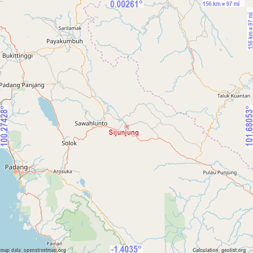
Sijunjung GPS coordinates[2]
0° 42' 1.8" South, 100° 58' 38.64" East
| Map corner | latitude | longitude |
|---|---|---|
| Upper-left | 0.00261°, | 100.27428° |
| Center: | -0.7005°, | 100.9774° |
| Lower-right: | -1.4035°, | 101.68053° |
| Map W x H: | 156.3×156.3 km | = 97.1×97.1mi |
| max Lat: | 5.88969° ⇑5.8% North |
| Sijunjung: | -0.7005° |
| min Lat: | ⇓94.2% South -10.934° |
| min Long | Sijunjung | max Long |
| 95.1345° | 100.9774° | 140.9419° |
| W 3.4%⇐ | ⇒96.6% E |
Elevation
Elevation of Sijunjung is 167 m = 548 ft, and this is 62.7 m = 206 ft below average elevation for this country.
| Max E: |
3185 m = 10449 ft | 39.7% |
| Avg. | 229.7 m = 754 ft | |
| Sijunjung | 167 m = 548 ft | |
Min E: |
-1 m = -3 ft | 60.3% |
See also: Indonesia elevation on elevation.city.
Geographical zone
Sijunjung is located in South Torrid zone (between Equator and Tropic of Capricorn). Distance of Equator is 77.9 km =48.4 mi to North.| Distance of | km | miles | from Sijunjung |
|---|---|---|---|
| Equator | 77.9 | 48.4 | to North |
| Tropic Capricorn | 2528 | 1570.8 | to South |
| Antarctic Circle | 7323.3 | 4550.5 | to South |
| South Pole | 9929.2 | 6169.7 | to South |


Nearby cities:
15 places around Sijunjung: (largest is in red/bold)
• Gunung Talang
45.1 km =28 mi,  239°
239°
• Kototujuh
12.2 km =7.6 mi,  306°
306°
• Kumanis
23.4 km =14.5 mi,  315°
315°
• Muaro
4.6 km =2.9 mi,  332°
332°
• Saruaso
44.8 km =27.8 mi,  302°
302°
• Singkarak
41.6 km =25.8 mi,  271°
271°
• Sirukam
31.9 km =19.8 mi,  229°
229°
• Solok
37.3 km =23.2 mi,  252°
252°
• Sulitair
37.9 km =23.5 mi,  284°
284°
• Sumpur Kudus
29.8 km =18.5 mi,  345°
345°
• Talawi
28.8 km =17.9 mi,  293°
293°
• Tanjung Mas
32.1 km =19.9 mi, 314°
• Tanjungampalu
18 km =11.2 mi, 292°
• Tanjungampalu
19 km =11.8 mi, 297°
• Tanjunggadang
26 km =16.2 mi,  109°
109°
Sources, notices
• [Note1] Compared only with cities in Indonesia existing in our database
• [Src1] Map data: © OpenStreetMap contributors (CC-BY-SA)
• [Src2] Other city data from geonames.org with taken over terms of usage.
• [Src3] Geographical zone / Annual Mean Temperature by Robert A. Rohde @ Wikipedia
