Ruser geodata
Ruser (East Java) is a seat of a fourth-order administrative division; located in Indonesia in Asia/Jakarta (GMT+7) time zone. In our database, there are 407 cities with bigger population. Compared to other cities in Indonesia, 71.8% of cities are located further ↑North; 50.2% of cities are located further ←West and 72.3% of cities have lower elevation than Ruser. Note1


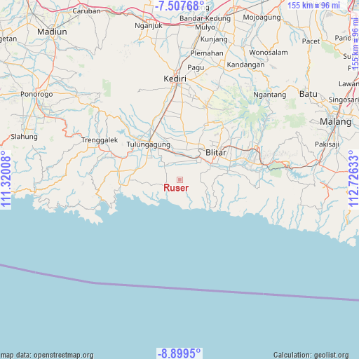
Ruser GPS coordinates[2]
8° 12' 15.12" South, 112° 1' 23.52" East
| Map corner | latitude | longitude |
|---|---|---|
| Upper-left | -7.50768°, | 111.32008° |
| Center: | -8.2042°, | 112.0232° |
| Lower-right: | -8.8995°, | 112.72633° |
| Map W x H: | 154.8×154.8 km | = 96.2×96.2mi |
| max Lat: | 5.88969° ⇑71.8% North |
| Ruser: | -8.2042° |
| min Lat: | ⇓28.2% South -10.934° |
| min Long | Ruser | max Long |
| 95.1345° | 112.0232° | 140.9419° |
| W 50.2%⇐ | ⇒49.8% E |
Elevation
Elevation of Ruser is 326 m = 1070 ft, and this is 96.3 m = 316 ft above average elevation for this country.
| Max E: |
3185 m = 10449 ft | 27.7% |
| Ruser | 326 m 1070 ft | |
| Avg. | 229.7 m = 754 ft | |
Min E: |
-1 m = -3 ft | 72.3% |
See also: Indonesia elevation on elevation.city.
Geographical zone
Ruser is located in South Torrid zone (between Equator and Tropic of Capricorn). Distance of Equator is 912.2 km =566.8 mi to North.| Distance of | km | miles | from Ruser |
|---|---|---|---|
| Equator | 912.2 | 566.8 | to North |
| Tropic Capricorn | 1693.7 | 1052.4 | to South |
| Antarctic Circle | 6489 | 4032.1 | to South |
| South Pole | 9094.8 | 5651.2 | to South |


Nearby cities:
15 places around Ruser: (largest is in red/bold)
• Demuk
2.7 km =1.7 mi,  305°
305°
• Kalidawe
5.6 km =3.5 mi,  192°
192°
• Kaligentong
4.5 km =2.8 mi,  233°
233°
• Kebonsari
5.1 km =3.2 mi,  84°
84°
• Kedungdowo
5.3 km =3.3 mi,  271°
271°
• Manding
4.6 km =2.9 mi,  256°
256°
• Maron
3.6 km =2.2 mi, 77°
• Miribanteng
3.5 km =2.2 mi,  172°
172°
• Nganggrek
5.1 km =3.2 mi,  300°
300°
• Ngluweng Dua
4.7 km =2.9 mi,  328°
328°
• Pakisaji
3.9 km =2.4 mi,  108°
108°
• Panggungduwet
1 km =0.6 mi,  90°
90°
• Panggunguni
2.3 km =1.4 mi, 274°
• Sumberbendo
3.2 km =2 mi,  203°
203°
• Tenggong
5.3 km =3.3 mi,  3°
3°
Sources, notices
• [Note1] Compared only with cities in Indonesia existing in our database
• [Src1] Map data: © OpenStreetMap contributors (CC-BY-SA)
• [Src2] Other city data from geonames.org with taken over terms of usage.
• [Src3] Geographical zone / Annual Mean Temperature by Robert A. Rohde @ Wikipedia
