Purworejo geodata
Purworejo (East Java) is a seat of a fourth-order administrative division; located in Indonesia in Asia/Jakarta (GMT+7) time zone. In our database, there are 407 cities with bigger population. Compared to other cities in Indonesia, 76.8% of cities are located further ↓South; 51% of cities are located further →East and 93.7% of cities have higher elevation than Purworejo. Note1


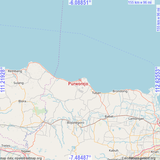
Purworejo GPS coordinates[2]
6° 47' 13.92" South, 111° 55' 20.64" East
| Map corner | latitude | longitude |
|---|---|---|
| Upper-left | -6.08851°, | 111.21928° |
| Center: | -6.7872°, | 111.9224° |
| Lower-right: | -7.48487°, | 112.62553° |
| Map W x H: | 155.3×155.3 km | = 96.5×96.5mi |
| max Lat: | 5.88969° ⇑23.2% North |
| Purworejo: | -6.7872° |
| min Lat: | ⇓76.8% South -10.934° |
| min Long | Purworejo | max Long |
| 95.1345° | 111.9224° | 140.9419° |
| W 49%⇐ | ⇒51% E |
Elevation
Elevation of Purworejo is 8 m = 26 ft, and this is 221.7 m = 727 ft below average elevation for this country.
| Max E: |
3185 m = 10449 ft | 93.7% |
| Avg. | 229.7 m = 754 ft | |
| Purworejo | 8 m = 26 ft | |
Min E: |
-1 m = -3 ft | 6.3% |
See also: Indonesia elevation on elevation.city.
Geographical zone
Purworejo is located in South Torrid zone (between Equator and Tropic of Capricorn). Distance of Equator is 754.7 km =468.9 mi to North.| Distance of | km | miles | from Purworejo |
|---|---|---|---|
| Equator | 754.7 | 468.9 | to North |
| Tropic Capricorn | 1851.3 | 1150.3 | to South |
| Antarctic Circle | 6646.5 | 4129.9 | to South |
| South Pole | 9252.4 | 5749.2 | to South |


Nearby cities:
15 places around Purworejo: (largest is in red/bold)
• Awarawar
2.2 km =1.4 mi,  42°
42°
• Glondong
3.4 km =2.1 mi,  260°
260°
• Karangasem
4 km =2.5 mi,  238°
238°
• Karangdowo
3 km =1.9 mi, 261°
• Mentoso
6.5 km =4 mi,  96°
96°
• Merkawang
4.3 km =2.7 mi, 238°
• Mliwang
6.2 km =3.9 mi,  213°
213°
• Rawasan
6.2 km =3.9 mi, 99°
• Remen
4.8 km =3 mi,  71°
71°
• Sobontoro
6.7 km =4.2 mi, 257°
• Sugihan
6.7 km =4.2 mi,  151°
151°
• Sumberejo
6.3 km =3.9 mi,  245°
245°
• Sumurgeneng
4.5 km =2.8 mi,  110°
110°
• Temuji
0.9 km =0.6 mi,  233°
233°
• Tobo
5.7 km =3.5 mi,  168°
168°
Sources, notices
• [Note1] Compared only with cities in Indonesia existing in our database
• [Src1] Map data: © OpenStreetMap contributors (CC-BY-SA)
• [Src2] Other city data from geonames.org with taken over terms of usage.
• [Src3] Geographical zone / Annual Mean Temperature by Robert A. Rohde @ Wikipedia
