Popnam geodata
Popnam (East Nusa Tenggara) is a seat of a fourth-order administrative division; located in Indonesia in Asia/Makassar (GMT+8) time zone. In our database, there are 407 cities with bigger population. Compared to other cities in Indonesia, 94% of cities are located further ↑North; 96.7% of cities are located further ←West and 76.6% of cities have lower elevation than Popnam. Note1


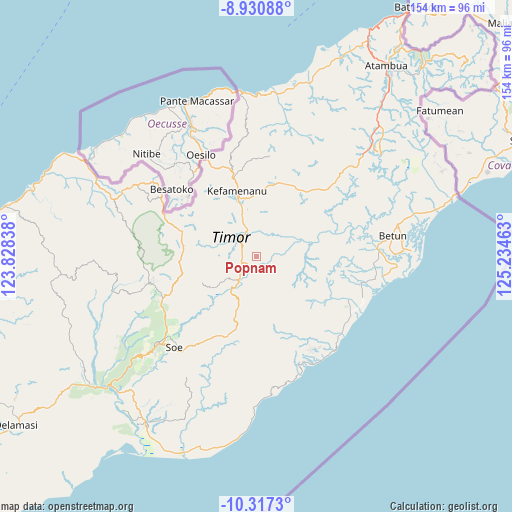
Popnam GPS coordinates[2]
9° 37' 29.28" South, 124° 31' 53.4" East
| Map corner | latitude | longitude |
|---|---|---|
| Upper-left | -8.93088°, | 123.82838° |
| Center: | -9.6248°, | 124.5315° |
| Lower-right: | -10.3173°, | 125.23463° |
| Map W x H: | 154.2×154.2 km | = 95.8×95.8mi |
| max Lat: | 5.88969° ⇑94% North |
| Popnam: | -9.6248° |
| min Lat: | ⇓6% South -10.934° |
| min Long | Popnam | max Long |
| 95.1345° | 124.5315° | 140.9419° |
| W 96.7%⇐ | ⇒3.3% E |
Elevation
Elevation of Popnam is 380 m = 1247 ft, and this is 150.3 m = 493 ft above average elevation for this country.
| Max E: |
3185 m = 10449 ft | 23.4% |
| Popnam | 380 m 1247 ft | |
| Avg. | 229.7 m = 754 ft | |
Min E: |
-1 m = -3 ft | 76.6% |
See also: Indonesia elevation on elevation.city.
Geographical zone
Popnam is located in South Torrid zone (between Equator and Tropic of Capricorn). Distance of Equator is 1070.2 km =665 mi to North.| Distance of | km | miles | from Popnam |
|---|---|---|---|
| Equator | 1070.2 | 665 | to North |
| Tropic Capricorn | 1535.7 | 954.2 | to South |
| Antarctic Circle | 6331 | 3933.9 | to South |
| South Pole | 8936.9 | 5553.1 | to South |


Nearby cities:
15 places around Popnam: (largest is in red/bold)
• Baanfaun
7.4 km =4.6 mi,  54°
54°
• Biito
3.9 km =2.4 mi,  131°
131°
• Bijeli
6.1 km =3.8 mi,  310°
310°
• Fatumuti
8.1 km =5 mi,  321°
321°
• Kiuola
9 km =5.6 mi,  296°
296°
• Naiola
9 km =5.6 mi,  341°
341°
• Nelabesa
8.3 km =5.2 mi,  91°
91°
• Neob
7.5 km =4.7 mi,  76°
76°
• Nibaaf
4.3 km =2.7 mi,  354°
354°
• Nifunaibesi
6.7 km =4.2 mi,  223°
223°
• Noemuti
7.5 km =4.7 mi,  327°
327°
• Nunhala
4.3 km =2.7 mi,  274°
274°
• Oenak
7.8 km =4.8 mi, 335°
• Pakaebena
7 km =4.3 mi, 323°
• Polen
8.9 km =5.5 mi, 219°
Sources, notices
• [Note1] Compared only with cities in Indonesia existing in our database
• [Src1] Map data: © OpenStreetMap contributors (CC-BY-SA)
• [Src2] Other city data from geonames.org with taken over terms of usage.
• [Src3] Geographical zone / Annual Mean Temperature by Robert A. Rohde @ Wikipedia
