Pototano geodata
Pototano (West Nusa Tenggara) is a populated place; located in Indonesia in Asia/Makassar (GMT+8) time zone. With population of 5,000 people, there are 386 cities with bigger population in this country. Compared to other cities in Indonesia, 80.7% of cities are located further ↑North; 79.1% of cities are located further ←West and 98.5% of cities have higher elevation than Pototano. Note1


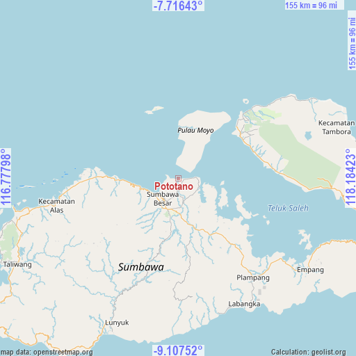
Pototano GPS coordinates[2]
8° 24' 45.36" South, 117° 28' 51.96" East
| Map corner | latitude | longitude |
|---|---|---|
| Upper-left | -7.71643°, | 116.77798° |
| Center: | -8.4126°, | 117.4811° |
| Lower-right: | -9.10752°, | 118.18423° |
| Map W x H: | 154.7×154.7 km | = 96.1×96.1mi |
| max Lat: | 5.88969° ⇑80.7% North |
| Pototano: | -8.4126° |
| min Lat: | ⇓19.3% South -10.934° |
| min Long | Pototano | max Long |
| 95.1345° | 117.4811° | 140.9419° |
| W 79.1%⇐ | ⇒20.9% E |
Elevation
Elevation of Pototano is 5 m = 16 ft, and this is 224.7 m = 737 ft below average elevation for this country.
| Max E: |
3185 m = 10449 ft | 98.5% |
| Avg. | 229.7 m = 754 ft | |
| Pototano | 5 m = 16 ft | |
Min E: |
-1 m = -3 ft | 1.5% |
See also: Indonesia elevation on elevation.city.
Geographical zone
Pototano is located in South Torrid zone (between Equator and Tropic of Capricorn). Distance of Equator is 935.4 km =581.2 mi to North.| Distance of | km | miles | from Pototano |
|---|---|---|---|
| Equator | 935.4 | 581.2 | to North |
| Tropic Capricorn | 1670.5 | 1038 | to South |
| Antarctic Circle | 6465.8 | 4017.7 | to South |
| South Pole | 9071.7 | 5636.9 | to South |


Nearby cities:
15 places around Pototano: (largest is in red/bold)
• Karangbalong
10.6 km =6.6 mi,  215°
215°
• Karangbugis
11.4 km =7.1 mi,  214°
214°
• Karangdima
12.1 km =7.5 mi,  234°
234°
• Kembansari
10.9 km =6.8 mi, 225°
• Labuhanaji
21.5 km =13.4 mi,  1°
1°
• Labuhanbadas
13.7 km =8.5 mi,  245°
245°
• Labuhansumbawa
11 km =6.8 mi, 232°
• Lukkarya
21.3 km =13.2 mi,  265°
265°
• Ngeru
12.2 km =7.6 mi,  161°
161°
• Osapsio
10.5 km =6.5 mi, 225°
• Penyaring Bawah
6.6 km =4.1 mi,  194°
194°
• Poto
9.6 km =6 mi,  181°
181°
• Sebewe
7.4 km =4.6 mi, 181°
• Songkar B
8.2 km =5.1 mi,  167°
167°
• Sumbawa Besar
11.2 km =7 mi, 216°
Sources, notices
• [Note1] Compared only with cities in Indonesia existing in our database
• [Src1] Map data: © OpenStreetMap contributors (CC-BY-SA)
• [Src2] Other city data from geonames.org with taken over terms of usage.
• [Src3] Geographical zone / Annual Mean Temperature by Robert A. Rohde @ Wikipedia
