Labuhanaji geodata
Labuhanaji (West Nusa Tenggara) is a seat of a fourth-order administrative division; located in Indonesia in Asia/Makassar (GMT+8) time zone. In our database, there are 407 cities with bigger population. Compared to other cities in Indonesia, 72.7% of cities are located further ↑North; 79.1% of cities are located further ←West and 92.1% of cities have higher elevation than Labuhanaji. Note1


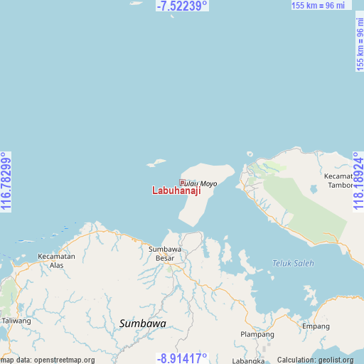
Labuhanaji GPS coordinates[2]
8° 13' 8.004" South, 117° 29' 9.996" East
| Map corner | latitude | longitude |
|---|---|---|
| Upper-left | -7.52239°, | 116.78299° |
| Center: | -8.21889°, | 117.48611° |
| Lower-right: | -8.91417°, | 118.18924° |
| Map W x H: | 154.8×154.8 km | = 96.2×96.2mi |
| max Lat: | 5.88969° ⇑72.7% North |
| Labuhanaji: | -8.21889° |
| min Lat: | ⇓27.3% South -10.934° |
| min Long | Labuhanaji | max Long |
| 95.1345° | 117.48611° | 140.9419° |
| W 79.1%⇐ | ⇒20.9% E |
Elevation
Elevation of Labuhanaji is 9 m = 30 ft, and this is 220.7 m = 724 ft below average elevation for this country.
| Max E: |
3185 m = 10449 ft | 92.1% |
| Avg. | 229.7 m = 754 ft | |
| Labuhanaji | 9 m = 30 ft | |
Min E: |
-1 m = -3 ft | 7.9% |
See also: Indonesia elevation on elevation.city.
Geographical zone
Labuhanaji is located in South Torrid zone (between Equator and Tropic of Capricorn). Distance of Equator is 913.9 km =567.9 mi to North.| Distance of | km | miles | from Labuhanaji |
|---|---|---|---|
| Equator | 913.9 | 567.9 | to North |
| Tropic Capricorn | 1692.1 | 1051.4 | to South |
| Antarctic Circle | 6487.3 | 4031 | to South |
| South Pole | 9093.2 | 5650.3 | to South |


Nearby cities:
15 places around Labuhanaji: (largest is in red/bold)
• Karangbalong
30.9 km =19.2 mi,  192°
192°
• Karangbugis
31.7 km =19.7 mi, 192°
• Karangdima
30.3 km =18.8 mi,  199°
199°
• Karangmete
29.7 km =18.5 mi,  102°
102°
• Kembansari
30.3 km =18.8 mi, 196°
• Labuhanbadas
30.2 km =18.8 mi,  205°
205°
• Labuhansumbawa
29.7 km =18.5 mi, 198°
• Lukkarya
31.9 km =19.8 mi,  223°
223°
• Osapsio
30 km =18.6 mi, 195°
• Penyaring Bawah
28 km =17.4 mi,  184°
184°
• Poto
31.1 km =19.3 mi, 181°
• Pototano
21.5 km =13.4 mi, 181°
• Sebewe
28.9 km =18 mi, 181°
• Songkar B
29.6 km =18.4 mi, 177°
• Sumbawa Besar
31.3 km =19.4 mi, 193°
Sources, notices
• [Note1] Compared only with cities in Indonesia existing in our database
• [Src1] Map data: © OpenStreetMap contributors (CC-BY-SA)
• [Src2] Other city data from geonames.org with taken over terms of usage.
• [Src3] Geographical zone / Annual Mean Temperature by Robert A. Rohde @ Wikipedia
