Pacitan geodata
Pacitan (East Java) is a seat of a second-order administrative division; located in Indonesia in Asia/Jakarta (GMT+7) time zone. In our database, there are 407 cities with bigger population. Compared to other cities in Indonesia, 71.2% of cities are located further ↑North; 63.5% of cities are located further →East and 90.6% of cities have higher elevation than Pacitan. Note1


Pacitan GPS coordinates[2]
8° 11' 38.004" South, 111° 6' 11.988" East
| Map corner | latitude | longitude |
|---|---|---|
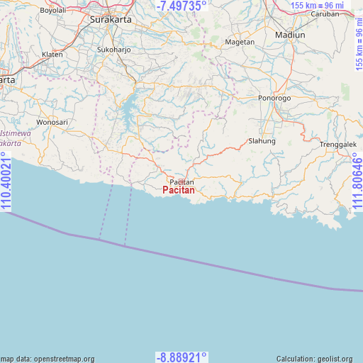
| Upper-left | -7.49735°, | 110.40021° |
| Center: | -8.19389°, | 111.10333° |
| Lower-right: | -8.88921°, | 111.80646° |
| Map W x H: | 154.8×154.8 km | = 96.2×96.2mi |
| max Lat: | 5.88969° ⇑71.2% North |
| Pacitan: | -8.19389° |
| min Lat: | ⇓28.8% South -10.934° |
| min Long | Pacitan | max Long |
| 95.1345° | 111.10333° | 140.9419° |
| W 36.5%⇐ | ⇒63.5% E |
Elevation
Elevation of Pacitan is 10 m = 33 ft, and this is 219.7 m = 721 ft below average elevation for this country.
| Max E: |
3185 m = 10449 ft | 90.6% |
| Avg. | 229.7 m = 754 ft | |
| Pacitan | 10 m = 33 ft | |
Min E: |
-1 m = -3 ft | 9.4% |
See also: Indonesia elevation on elevation.city.
Geographical zone
Pacitan is located in South Torrid zone (between Equator and Tropic of Capricorn). Distance of Equator is 911.1 km =566.1 mi to North.| Distance of | km | miles | from Pacitan |
|---|---|---|---|
| Equator | 911.1 | 566.1 | to North |
| Tropic Capricorn | 1694.8 | 1053.1 | to South |
| Antarctic Circle | 6490.1 | 4032.8 | to South |
| South Pole | 9096 | 5652 | to South |


Nearby cities:
15 places around Pacitan: (largest is in red/bold)
• Bangil
32.8 km =20.4 mi,  78°
78°
• Jatiroto
34.6 km =21.5 mi,  2°
2°
• Karangtengah
35.8 km =22.2 mi,  93°
93°
• Ketanggung
30.6 km =19 mi, 90°
• Krajan
11.6 km =7.2 mi,  316°
316°
• Krajan Mrayan
33.3 km =20.7 mi,  68°
68°
• Krajan Senepo
36 km =22.4 mi,  62°
62°
• Krajan Tugurejo
36 km =22.4 mi, 60°
• Ngangkruk
34.3 km =21.3 mi,  98°
98°
• Ngembel
36.2 km =22.5 mi, 71°
• Ngromo
34.7 km =21.6 mi, 91°
• Ploso
13.3 km =8.3 mi,  338°
338°
• Sudimoro
30 km =18.6 mi, 95°
• Sukorejo
31 km =19.3 mi, 100°
• Sunduk
34.7 km =21.6 mi, 88°
Sources, notices
• [Note1] Compared only with cities in Indonesia existing in our database
• [Src1] Map data: © OpenStreetMap contributors (CC-BY-SA)
• [Src2] Other city data from geonames.org with taken over terms of usage.
• [Src3] Geographical zone / Annual Mean Temperature by Robert A. Rohde @ Wikipedia
