Ploso geodata
Ploso (East Java) is a seat of a fourth-order administrative division; located in Indonesia in Asia/Jakarta (GMT+7) time zone. In our database, there are 407 cities with bigger population. Compared to other cities in Indonesia, 64.8% of cities are located further ↑North; 64.1% of cities are located further →East and 74% of cities have lower elevation than Ploso. Note1


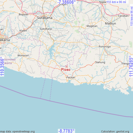
Ploso GPS coordinates[2]
8° 4' 58.008" South, 111° 3' 34.992" East
| Map corner | latitude | longitude |
|---|---|---|
| Upper-left | -7.38606°, | 110.3566° |
| Center: | -8.08278°, | 111.05972° |
| Lower-right: | -8.7783°, | 111.76285° |
| Map W x H: | 154.8×154.8 km | = 96.2×96.2mi |
| max Lat: | 5.88969° ⇑64.8% North |
| Ploso: | -8.08278° |
| min Lat: | ⇓35.2% South -10.934° |
| min Long | Ploso | max Long |
| 95.1345° | 111.05972° | 140.9419° |
| W 35.9%⇐ | ⇒64.1% E |
Elevation
Elevation of Ploso is 346 m = 1135 ft, and this is 116.3 m = 382 ft above average elevation for this country.
| Max E: |
3185 m = 10449 ft | 26% |
| Ploso | 346 m 1135 ft | |
| Avg. | 229.7 m = 754 ft | |
Min E: |
-1 m = -3 ft | 74% |
See also: Indonesia elevation on elevation.city.
Geographical zone
Ploso is located in South Torrid zone (between Equator and Tropic of Capricorn). Distance of Equator is 898.7 km =558.4 mi to North.| Distance of | km | miles | from Ploso |
|---|---|---|---|
| Equator | 898.7 | 558.4 | to North |
| Tropic Capricorn | 1707.2 | 1060.8 | to South |
| Antarctic Circle | 6502.5 | 4040.5 | to South |
| South Pole | 9108.3 | 5659.6 | to South |


Nearby cities:
15 places around Ploso: (largest is in red/bold)
• Bangil
37.4 km =23.2 mi,  99°
99°
• Broto
39.2 km =24.4 mi,  79°
79°
• Dawang
39.4 km =24.5 mi, 82°
• Jatiroto
23 km =14.3 mi,  15°
15°
• Ketanggung
37.6 km =23.4 mi,  109°
109°
• Krajan
5.2 km =3.2 mi,  219°
219°
• Krajan Caluk
37.5 km =23.3 mi, 82°
• Krajan Mrayan
35.8 km =22.2 mi,  90°
90°
• Krajan Senepo
37 km =23 mi, 83°
• Krajan Tengah
36 km =22.4 mi, 78°
• Krajan Tugurejo
36.7 km =22.8 mi, 81°
• Ngembel
39.1 km =24.3 mi, 91°
• Pacitan
13.3 km =8.3 mi,  158°
158°
• Sudimoro
37.9 km =23.5 mi, 113°
• Wonogiri
33.5 km =20.8 mi,  332°
332°
Sources, notices
• [Note1] Compared only with cities in Indonesia existing in our database
• [Src1] Map data: © OpenStreetMap contributors (CC-BY-SA)
• [Src2] Other city data from geonames.org with taken over terms of usage.
• [Src3] Geographical zone / Annual Mean Temperature by Robert A. Rohde @ Wikipedia
