Lontar geodata
Lontar (Banten) is a seat of a fourth-order administrative division; located in Indonesia in Asia/Jakarta (GMT+7) time zone. In our database, there are 407 cities with bigger population. Compared to other cities in Indonesia, 88% of cities are located further ↓South; 88.4% of cities are located further →East and 99.4% of cities have higher elevation than Lontar. Note1


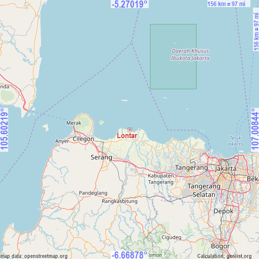
Lontar GPS coordinates[2]
5° 58' 11.748" South, 106° 18' 19.116" East
| Map corner | latitude | longitude |
|---|---|---|
| Upper-left | -5.27019°, | 105.60219° |
| Center: | -5.96993°, | 106.30531° |
| Lower-right: | -6.66878°, | 107.00844° |
| Map W x H: | 155.5×155.5 km | = 96.6×96.6mi |
| max Lat: | 5.88969° ⇑12% North |
| Lontar: | -5.96993° |
| min Lat: | ⇓88% South -10.934° |
| min Long | Lontar | max Long |
| 95.1345° | 106.30531° | 140.9419° |
| W 11.6%⇐ | ⇒88.4% E |
Elevation
Elevation of Lontar is 3 m = 10 ft, and this is 226.7 m = 744 ft below average elevation for this country.
| Max E: |
3185 m = 10449 ft | 99.4% |
| Avg. | 229.7 m = 754 ft | |
| Lontar | 3 m = 10 ft | |
Min E: |
-1 m = -3 ft | 0.6% |
See also: Indonesia elevation on elevation.city.
Geographical zone
Lontar is located in South Torrid zone (between Equator and Tropic of Capricorn). Distance of Equator is 663.8 km =412.5 mi to North.| Distance of | km | miles | from Lontar |
|---|---|---|---|
| Equator | 663.8 | 412.5 | to North |
| Tropic Capricorn | 1942.1 | 1206.8 | to South |
| Antarctic Circle | 6737.4 | 4186.4 | to South |
| South Pole | 9343.3 | 5805.7 | to South |


Nearby cities:
15 places around Lontar: (largest is in red/bold)
• Bojonegara
23.2 km =14.4 mi,  269°
269°
• Ciruas
19 km =11.8 mi,  204°
204°
• Curug
31.7 km =19.7 mi, 267°
• Karangdawa Barat
28 km =17.4 mi,  230°
230°
• Kresek
19.7 km =12.2 mi,  155°
155°
• Kubangkepuh
31.6 km =19.6 mi,  284°
284°
• Langgen
1.5 km =0.9 mi,  178°
178°
• Padukan
29.9 km =18.6 mi, 228°
• Pakuncen
26 km =16.2 mi, 273°
• Pangarengan
25.8 km =16 mi, 273°
• Pasagipasir
31.2 km =19.4 mi,  220°
220°
• Pekijing
28.1 km =17.5 mi, 232°
• Serang
23.2 km =14.4 mi, 225°
• Timurjaya
17.5 km =10.9 mi,  352°
352°
• VILLA PERMATA HIJAU
25.7 km =16 mi,  251°
251°
Sources, notices
• [Note1] Compared only with cities in Indonesia existing in our database
• [Src1] Map data: © OpenStreetMap contributors (CC-BY-SA)
• [Src2] Other city data from geonames.org with taken over terms of usage.
• [Src3] Geographical zone / Annual Mean Temperature by Robert A. Rohde @ Wikipedia
