Lodoyo geodata
Lodoyo (East Java) is a seat of a third-order administrative division; located in Indonesia in Asia/Jakarta (GMT+7) time zone. In our database, there are 407 cities with bigger population. Compared to other cities in Indonesia, 69.3% of cities are located further ↑North; 51.6% of cities are located further ←West and 58.3% of cities have lower elevation than Lodoyo. Note1


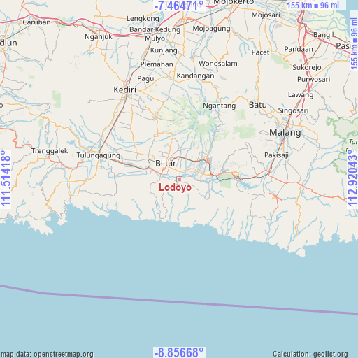
Lodoyo GPS coordinates[2]
8° 9' 40.68" South, 112° 13' 2.28" East
| Map corner | latitude | longitude |
|---|---|---|
| Upper-left | -7.46471°, | 111.51418° |
| Center: | -8.1613°, | 112.2173° |
| Lower-right: | -8.85668°, | 112.92043° |
| Map W x H: | 154.8×154.8 km | = 96.2×96.2mi |
| max Lat: | 5.88969° ⇑69.3% North |
| Lodoyo: | -8.1613° |
| min Lat: | ⇓30.7% South -10.934° |
| min Long | Lodoyo | max Long |
| 95.1345° | 112.2173° | 140.9419° |
| W 51.6%⇐ | ⇒48.4% E |
Elevation
Elevation of Lodoyo is 148 m = 486 ft, and this is 81.7 m = 268 ft below average elevation for this country.
| Max E: |
3185 m = 10449 ft | 41.7% |
| Avg. | 229.7 m = 754 ft | |
| Lodoyo | 148 m = 486 ft | |
Min E: |
-1 m = -3 ft | 58.3% |
See also: Indonesia elevation on elevation.city.
Geographical zone
Lodoyo is located in South Torrid zone (between Equator and Tropic of Capricorn). Distance of Equator is 907.5 km =563.9 mi to North.| Distance of | km | miles | from Lodoyo |
|---|---|---|---|
| Equator | 907.5 | 563.9 | to North |
| Tropic Capricorn | 1698.5 | 1055.4 | to South |
| Antarctic Circle | 6493.7 | 4035 | to South |
| South Pole | 9099.6 | 5654.2 | to South |


Nearby cities:
15 places around Lodoyo: (largest is in red/bold)
• Bacem
4 km =2.5 mi,  156°
156°
• Darungan Satu
4.5 km =2.8 mi,  272°
272°
• Jegu
2.2 km =1.4 mi,  59°
59°
• Jinglong
1.6 km =1 mi,  108°
108°
• Kanigoro
3.5 km =2.2 mi,  3°
3°
• Karangsono
2.6 km =1.6 mi,  332°
332°
• Kedungbunder
2.1 km =1.3 mi,  208°
208°
• Kembangarum
0.2 km =0.1 mi,  346°
346°
• Klampok
3.4 km =2.1 mi,  227°
227°
• Satrejan
2.1 km =1.3 mi,  10°
10°
• Serut
3.3 km =2.1 mi,  306°
306°
• Sukorejo
1.9 km =1.2 mi,  127°
127°
• Sumberrejo
3.1 km =1.9 mi, 132°
• Sutojayan
1.9 km =1.2 mi,  183°
183°
• Wonorejo
1 km =0.6 mi,  174°
174°
Sources, notices
• [Note1] Compared only with cities in Indonesia existing in our database
• [Src1] Map data: © OpenStreetMap contributors (CC-BY-SA)
• [Src2] Other city data from geonames.org with taken over terms of usage.
• [Src3] Geographical zone / Annual Mean Temperature by Robert A. Rohde @ Wikipedia
