Kubu geodata
Kubu (West Kalimantan) is a seat of a third-order administrative division; located in Indonesia in Asia/Pontianak (GMT+7) time zone. In our database, there are 407 cities with bigger population. Compared to other cities in Indonesia, 94.6% of cities are located further ↓South; 66% of cities are located further →East and 99.4% of cities have higher elevation than Kubu. Note1


Kubu GPS coordinates[2]
0° 29' 8.736" South, 109° 21' 18.468" East
| Map corner | latitude | longitude |
|---|---|---|
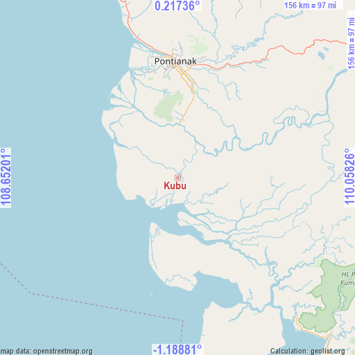
| Upper-left | 0.21736°, | 108.65201° |
| Center: | -0.48576°, | 109.35513° |
| Lower-right: | -1.18881°, | 110.05826° |
| Map W x H: | 156.4×156.4 km | = 97.2×97.2mi |
| max Lat: | 5.88969° ⇑5.4% North |
| Kubu: | -0.48576° |
| min Lat: | ⇓94.6% South -10.934° |
| min Long | Kubu | max Long |
| 95.1345° | 109.35513° | 140.9419° |
| W 34%⇐ | ⇒66% E |
Elevation
Elevation of Kubu is 3 m = 10 ft, and this is 226.7 m = 744 ft below average elevation for this country.
| Max E: |
3185 m = 10449 ft | 99.4% |
| Avg. | 229.7 m = 754 ft | |
| Kubu | 3 m = 10 ft | |
Min E: |
-1 m = -3 ft | 0.6% |
See also: Indonesia elevation on elevation.city.
Geographical zone
Kubu is located in South Torrid zone (between Equator and Tropic of Capricorn). Distance of Equator is 54 km =33.6 mi to North.| Distance of | km | miles | from Kubu |
|---|---|---|---|
| Equator | 54 | 33.6 | to North |
| Tropic Capricorn | 2551.9 | 1585.7 | to South |
| Antarctic Circle | 7347.2 | 4565.3 | to South |
| South Pole | 9953.1 | 6184.6 | to South |


Nearby cities:
15 places around Kubu: (largest is in red/bold)
• Batuampar
33.8 km =21 mi,  146°
146°
• Mandor
89.9 km =55.9 mi,  358°
358°
• Mempawah
104.4 km =64.9 mi,  335°
335°
• Menjalin
106.2 km =66 mi, 358°
• Padangtikar
25 km =15.5 mi,  204°
204°
• Pontianak
50.6 km =31.4 mi, 356°
• Pontianak Barat
52.1 km =32.4 mi, 355°
• Sukadana
107.7 km =66.9 mi,  142°
142°
• Sungai Pinyuh
90.9 km =56.5 mi, 340°
• Sungai Raya
40.3 km =25 mi,  7°
7°
• Sungaikakap
51 km =31.7 mi, 341°
• Tayan
97.1 km =60.3 mi,  58°
58°
• Telukpakedai
35.8 km =22.2 mi,  313°
313°
• Terentang
31.7 km =19.7 mi,  68°
68°
• Toho
101.6 km =63.1 mi,  351°
351°
Sources, notices
• [Note1] Compared only with cities in Indonesia existing in our database
• [Src1] Map data: © OpenStreetMap contributors (CC-BY-SA)
• [Src2] Other city data from geonames.org with taken over terms of usage.
• [Src3] Geographical zone / Annual Mean Temperature by Robert A. Rohde @ Wikipedia
