Bareng geodata
Bareng (East Nusa Tenggara) is a seat of a fourth-order administrative division; located in Indonesia in Asia/Makassar (GMT+8) time zone. In our database, there are 407 cities with bigger population. Compared to other cities in Indonesia, 69.9% of cities are located further ↑North; 93.7% of cities are located further ←West and 83% of cities have higher elevation than Bareng. Note1


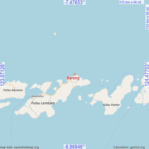
Bareng GPS coordinates[2]
8° 10' 23.16" South, 123° 46' 27.84" East
| Map corner | latitude | longitude |
|---|---|---|
| Upper-left | -7.47653°, | 123.07128° |
| Center: | -8.1731°, | 123.7744° |
| Lower-right: | -8.86846°, | 124.47753° |
| Map W x H: | 154.8×154.8 km | = 96.2×96.2mi |
| max Lat: | 5.88969° ⇑69.9% North |
| Bareng: | -8.1731° |
| min Lat: | ⇓30.1% South -10.934° |
| min Long | Bareng | max Long |
| 95.1345° | 123.7744° | 140.9419° |
| W 93.7%⇐ | ⇒6.3% E |
Elevation
Elevation of Bareng is 16 m = 52 ft, and this is 213.7 m = 701 ft below average elevation for this country.
| Max E: |
3185 m = 10449 ft | 83% |
| Avg. | 229.7 m = 754 ft | |
| Bareng | 16 m = 52 ft | |
Min E: |
-1 m = -3 ft | 17% |
See also: Indonesia elevation on elevation.city.
Geographical zone
Bareng is located in South Torrid zone (between Equator and Tropic of Capricorn). Distance of Equator is 908.8 km =564.7 mi to North.| Distance of | km | miles | from Bareng |
|---|---|---|---|
| Equator | 908.8 | 564.7 | to North |
| Tropic Capricorn | 1697.2 | 1054.6 | to South |
| Antarctic Circle | 6492.4 | 4034.2 | to South |
| South Pole | 9098.3 | 5653.4 | to South |


Nearby cities:
15 places around Bareng: (largest is in red/bold)
• Atarodangkedang
4.3 km =2.7 mi,  227°
227°
• Atarodangwautu
2.1 km =1.3 mi,  235°
235°
• Bungalaleng
3.1 km =1.9 mi, 228°
• Buriwutung
3.9 km =2.4 mi,  106°
106°
• Hoelea
6 km =3.7 mi,  217°
217°
• Kaohua
6.1 km =3.8 mi,  127°
127°
• Leuburi
6.2 km =3.9 mi, 132°
• Leudawan
6.8 km =4.2 mi,  139°
139°
• Leuwayang
3.9 km =2.4 mi, 226°
• Leuwohung
1.9 km =1.2 mi,  90°
90°
• Lewutung
4.6 km =2.9 mi, 113°
• Peuhaq
2.6 km =1.6 mi,  100°
100°
• Wairiang
5.3 km =3.3 mi, 113°
• Weikoro
6.6 km =4.1 mi,  115°
115°
• Werangrae
1.4 km =0.9 mi, 239°
Sources, notices
• [Note1] Compared only with cities in Indonesia existing in our database
• [Src1] Map data: © OpenStreetMap contributors (CC-BY-SA)
• [Src2] Other city data from geonames.org with taken over terms of usage.
• [Src3] Geographical zone / Annual Mean Temperature by Robert A. Rohde @ Wikipedia
