Lewutung geodata
Lewutung (East Nusa Tenggara) is a seat of a fourth-order administrative division; located in Indonesia in Asia/Makassar (GMT+8) time zone. In our database, there are 407 cities with bigger population. Compared to other cities in Indonesia, 71% of cities are located further ↑North; 93.9% of cities are located further ←West and 57.7% of cities have higher elevation than Lewutung. Note1


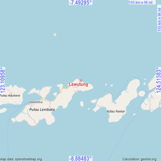
Lewutung GPS coordinates[2]
8° 11' 22.2" South, 123° 48' 45.72" East
| Map corner | latitude | longitude |
|---|---|---|
| Upper-left | -7.49295°, | 123.10958° |
| Center: | -8.1895°, | 123.8127° |
| Lower-right: | -8.88483°, | 124.51583° |
| Map W x H: | 154.8×154.8 km | = 96.2×96.2mi |
| max Lat: | 5.88969° ⇑71% North |
| Lewutung: | -8.1895° |
| min Lat: | ⇓29% South -10.934° |
| min Long | Lewutung | max Long |
| 95.1345° | 123.8127° | 140.9419° |
| W 93.9%⇐ | ⇒6.1% E |
Elevation
Elevation of Lewutung is 69 m = 226 ft, and this is 160.7 m = 527 ft below average elevation for this country.
| Max E: |
3185 m = 10449 ft | 57.7% |
| Avg. | 229.7 m = 754 ft | |
| Lewutung | 69 m = 226 ft | |
Min E: |
-1 m = -3 ft | 42.3% |
See also: Indonesia elevation on elevation.city.
Geographical zone
Lewutung is located in South Torrid zone (between Equator and Tropic of Capricorn). Distance of Equator is 910.6 km =565.8 mi to North.| Distance of | km | miles | from Lewutung |
|---|---|---|---|
| Equator | 910.6 | 565.8 | to North |
| Tropic Capricorn | 1695.3 | 1053.4 | to South |
| Antarctic Circle | 6490.6 | 4033.1 | to South |
| South Pole | 9096.5 | 5652.3 | to South |


Nearby cities:
15 places around Lewutung: (largest is in red/bold)
• Aliuroba
6 km =3.7 mi,  205°
205°
• Atarodangwautu
5.9 km =3.7 mi,  276°
276°
• Bareng
4.6 km =2.9 mi,  293°
293°
• Buriwutung
0.8 km =0.5 mi,  328°
328°
• Hadingrobi
6.3 km =3.9 mi, 207°
• Kaohua
1.9 km =1.2 mi,  161°
161°
• Leuburi
2.4 km =1.5 mi,  172°
172°
• Leudawan
3.3 km =2.1 mi,  176°
176°
• Leutubung Satu
4.3 km =2.7 mi,  185°
185°
• Leuwohung
2.9 km =1.8 mi,  308°
308°
• Peuhaq
2.2 km =1.4 mi, 309°
• Roun Satu
3.8 km =2.4 mi, 179°
• Wairiang
0.7 km =0.4 mi,  113°
113°
• Weikoro
2 km =1.2 mi,  120°
120°
• Werangrae
5.5 km =3.4 mi, 281°
Sources, notices
• [Note1] Compared only with cities in Indonesia existing in our database
• [Src1] Map data: © OpenStreetMap contributors (CC-BY-SA)
• [Src2] Other city data from geonames.org with taken over terms of usage.
• [Src3] Geographical zone / Annual Mean Temperature by Robert A. Rohde @ Wikipedia
