Astanajapura geodata
Astanajapura (West Java) is a populated place; located in Indonesia in Asia/Jakarta (GMT+7) time zone. With population of 148,047 people, there are 79 cities with bigger population in this country. Compared to other cities in Indonesia, 76.3% of cities are located further ↓South; 69.7% of cities are located further →East and 97.2% of cities have higher elevation than Astanajapura. Note1


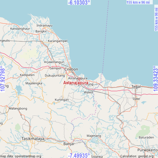
Astanajapura GPS coordinates[2]
6° 48' 6.12" South, 108° 37' 51.96" East
| Map corner | latitude | longitude |
|---|---|---|
| Upper-left | -6.10303°, | 107.92798° |
| Center: | -6.8017°, | 108.6311° |
| Lower-right: | -7.49935°, | 109.33423° |
| Map W x H: | 155.3×155.3 km | = 96.5×96.5mi |
| max Lat: | 5.88969° ⇑23.7% North |
| Astanajapura: | -6.8017° |
| min Lat: | ⇓76.3% South -10.934° |
| min Long | Astanajapura | max Long |
| 95.1345° | 108.6311° | 140.9419° |
| W 30.3%⇐ | ⇒69.7% E |
Elevation
Elevation of Astanajapura is 6 m = 20 ft, and this is 223.7 m = 734 ft below average elevation for this country.
| Max E: |
3185 m = 10449 ft | 97.2% |
| Avg. | 229.7 m = 754 ft | |
| Astanajapura | 6 m = 20 ft | |
Min E: |
-1 m = -3 ft | 2.8% |
See also: Astanajapura elevation on elevation.city.
Geographical zone
Astanajapura is located in South Torrid zone (between Equator and Tropic of Capricorn). Distance of Equator is 756.3 km =469.9 mi to North.| Distance of | km | miles | from Astanajapura |
|---|---|---|---|
| Equator | 756.3 | 469.9 | to North |
| Tropic Capricorn | 1849.6 | 1149.3 | to South |
| Antarctic Circle | 6644.9 | 4128.9 | to South |
| South Pole | 9250.8 | 5748.2 | to South |


Nearby cities:
15 places around Astanajapura: (largest is in red/bold)
• Cikandang
21.7 km =13.5 mi,  179°
179°
• Cirebon
13.4 km =8.3 mi,  322°
322°
• Dukuhmaja
23 km =14.3 mi, 175°
• Karangsembung
5.4 km =3.4 mi,  166°
166°
• Klangenan
23.5 km =14.6 mi,  295°
295°
• Luragung
24 km =14.9 mi, 178°
• Manis Mekarwangi
23.5 km =14.6 mi,  187°
187°
• Modis
23.9 km =14.9 mi,  197°
197°
• Olejet
22.3 km =13.9 mi, 197°
• Plumbon
20.5 km =12.7 mi, 301°
• Rahayu
23.9 km =14.9 mi, 183°
• Sindang
22.8 km =14.2 mi, 193°
• Sindangsuka
23.2 km =14.4 mi, 179°
• Sumber
17 km =10.6 mi,  285°
285°
• Weru
17.3 km =10.7 mi,  305°
305°
Sources, notices
• [Note1] Compared only with cities in Indonesia existing in our database
• [Src1] Map data: © OpenStreetMap contributors (CC-BY-SA)
• [Src2] Other city data from geonames.org with taken over terms of usage.
• [Src3] Geographical zone / Annual Mean Temperature by Robert A. Rohde @ Wikipedia
