Rosses Point geodata
Rosses Point (Connaught) is a populated place; located in Ireland in Europe/Dublin (GMT+1) time zone. With population of 824 people, there are 390 cities with bigger population in this country. Compared to other cities in Ireland, 93.2% of cities are located further ↓South; 77% of cities are located further →East and 70.4% of cities have higher elevation than Rosses Point. Note1


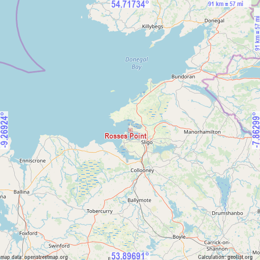
Rosses Point GPS coordinates[2]
54° 18' 33.012" North, 8° 33' 57.996" West
| Map corner | latitude | longitude |
|---|---|---|
| Upper-left | 54.71734°, | -9.26924° |
| Center: | 54.30917°, | -8.56611° |
| Lower-right: | 53.89691°, | -7.86299° |
| Map W x H: | 91.2×91.2 km | = 56.7×56.7mi |
| max Lat: | 55.25° ⇑6.8% North |
| Rosses Point: | 54.30917° |
| min Lat: | ⇓93.2% South 51.52487° |
| min Long | Rosses Point | max Long |
| -10.26889° | -8.56611° | -6.04944° |
| W 23%⇐ | ⇒77% E |
Elevation
Elevation of Rosses Point is 26 m = 85 ft, and this is 28.5 m = 94 ft below average elevation for this country.
| Max E: |
262 m = 860 ft | 70.4% |
| Avg. | 54.5 m = 179 ft | |
| Rosses Point | 26 m = 85 ft | |
Min E: |
0 m = 0 ft | 29.6% |
See also: Ireland elevation on elevation.city.
Geographical zone
Rosses Point is located in North temperate zone (between Tropic of Cancer and the Arctic Circle). Distance of this North polar circle is 1362.6 km =846.7 mi to North.| Distance of | km | miles | from Rosses Point |
|---|---|---|---|
| North Pole | 3968.4 | 2465.8 | to North |
| Arctic Circle | 1362.6 | 846.7 | to North |
| Tropic Cancer | 3432.7 | 2133 | to South |
| Equator | 6038.6 | 3752.2 | to South |


Nearby cities:
15 places around Rosses Point: (largest is in red/bold)
• Ballisodare
11.5 km =7.1 mi,  161°
161°
• Ballymote
25.3 km =15.7 mi,  172°
172°
• Ballyshannon
32.6 km =20.3 mi,  49°
49°
• Bundoran
26.3 km =16.3 mi,  44°
44°
• Collooney
14.6 km =9.1 mi, 162°
• Coolaney
14.7 km =9.1 mi,  188°
188°
• Dromahair
19.2 km =11.9 mi,  116°
116°
• Grange
9.7 km =6 mi,  15°
15°
• Inishcrone
35.7 km =22.2 mi,  253°
253°
• Killybegs
36.8 km =22.9 mi,  11°
11°
• Kinlough
24.1 km =15 mi, 49°
• Manorhamilton
25.3 km =15.7 mi,  90°
90°
• Sligo
7.7 km =4.8 mi, 124°
• Strandhill
4.5 km =2.8 mi,  203°
203°
• Tobercurry
30.8 km =19.1 mi, 200°
Sources, notices
• [Note1] Compared only with cities in Ireland existing in our database
• [Src1] Map data: © OpenStreetMap contributors (CC-BY-SA)
• [Src2] Other city data from geonames.org with taken over terms of usage.
• [Src3] Geographical zone / Annual Mean Temperature by Robert A. Rohde @ Wikipedia
