Mazkeret Batya geodata
Mazkeret Batya (Central District) is a populated place; located in Israel in Asia/Jerusalem (GMT+3) time zone. With population of 8,034 people, there are 94 cities with bigger population in this country. Compared to other cities in Israel, 81.1% of cities are located further ↑North; 81.7% of cities are located further →East and 59.2% of cities have higher elevation than Mazkeret Batya. Note1


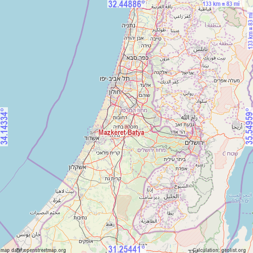
Mazkeret Batya GPS coordinates[2]
31° 51' 12.852" North, 34° 50' 47.256" East
| Map corner | latitude | longitude |
|---|---|---|
| Upper-left | 32.44886°, | 34.14334° |
| Center: | 31.85357°, | 34.84646° |
| Lower-right: | 31.25441°, | 35.54959° |
| Map W x H: | 132.8×132.8 km | = 82.5×82.5mi |
| max Lat: | 33.27918° ⇑81.1% North |
| Mazkeret Batya: | 31.85357° |
| min Lat: | ⇓18.9% South 29.55805° |
| min Long | Mazkeret Batya | max Long |
| 34.57149° | 34.84646° | 35.81084° |
| W 18.3%⇐ | ⇒81.7% E |
Elevation
Elevation of Mazkeret Batya is 75 m = 246 ft, and this is 148.4 m = 487 ft below average elevation for this country.
| Max E: |
988 m = 3241 ft | 59.2% |
| Avg. | 223.4 m = 733 ft | |
| Mazkeret Batya | 75 m = 246 ft | |
Min E: |
-380 m = -1247 ft | 40.8% |
See also: Israel elevation on elevation.city.
Geographical zone
Mazkeret Batya is located in North temperate zone (between Tropic of Cancer and the Arctic Circle). Distance of this Northern Tropic circle is 935.9 km =581.5 mi to South.| Distance of | km | miles | from Mazkeret Batya |
|---|---|---|---|
| North Pole | 6465.3 | 4017.3 | to North |
| Arctic Circle | 3859.4 | 2398.1 | to North |
| Tropic Cancer | 935.9 | 581.5 | to South |
| Equator | 3541.8 | 2200.8 | to South |


Nearby cities:
15 places around Mazkeret Batya: (largest is in red/bold)
• Bet Dagan
16.6 km =10.3 mi,  354°
354°
• Bnei Ayish
12 km =7.5 mi,  229°
229°
• Gan Yavne
15.1 km =9.4 mi,  240°
240°
• Gedera
7.6 km =4.7 mi, 235°
• Kefar H̱abad
14.9 km =9.3 mi,  1°
1°
• Lod
11.2 km =7 mi,  21°
21°
• Mevo horon
17.9 km =11.1 mi,  91°
91°
• Modi‘in Makkabbim Re‘ut
16.5 km =10.3 mi,  74°
74°
• Ness Ziona
9.6 km =6 mi,  331°
331°
• Nof Ayalon
13.8 km =8.6 mi,  81°
81°
• Ramla
8.6 km =5.3 mi,  12°
12°
• Reẖovot
5.6 km =3.5 mi,  324°
324°
• Rishon LeẔiyyon
14.1 km =8.8 mi,  337°
337°
• Shoham
18.6 km =11.6 mi,  30°
30°
• Yavné
10.4 km =6.5 mi,  285°
285°
Sources, notices
• [Note1] Compared only with cities in Israel existing in our database
• [Src1] Map data: © OpenStreetMap contributors (CC-BY-SA)
• [Src2] Other city data from geonames.org with taken over terms of usage.
• [Src3] Geographical zone / Annual Mean Temperature by Robert A. Rohde @ Wikipedia
