Saint Thomas Mount geodata
Saint Thomas Mount (Tamil Nadu) is a populated place; located in India in Asia/Kolkata (GMT+5.5) time zone. With population of 43,223 people, there are 1021 cities with bigger population in this country. Compared to other cities in India, 86.3% of cities are located further ↑North; 69.6% of cities are located further ←West and 86.8% of cities have higher elevation than Saint Thomas Mount. Note1


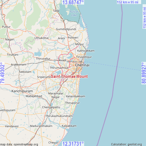
Saint Thomas Mount GPS coordinates[2]
13° 0' 12.024" North, 80° 11' 46.104" East
| Map corner | latitude | longitude |
|---|---|---|
| Upper-left | 13.68747°, | 79.49302° |
| Center: | 13.00334°, | 80.19614° |
| Lower-right: | 12.31731°, | 80.89927° |
| Map W x H: | 152.3×152.4 km | = 94.6×94.7mi |
| max Lat: | 34.9274° ⇑86.3% North |
| Saint Thomas Mount: | 13.00334° |
| min Lat: | ⇓13.7% South 8.09008° |
| min Long | Saint Thomas Mo | max Long |
| 68.82655° | 80.19614° | 96.81° |
| W 69.6%⇐ | ⇒30.4% E |
Elevation
Elevation of Saint Thomas Mount is 25 m = 82 ft, and this is 270.6 m = 888 ft below average elevation for this country.
| Max E: |
3681 m = 12077 ft | 86.8% |
| Avg. | 295.6 m = 970 ft | |
| Saint Thomas Mount | 25 m = 82 ft | |
Min E: |
1 m = 3 ft | 13.2% |
See also: Saint Thomas Mount elevation on elevation.city.
Geographical zone
Saint Thomas Mount is located in North Torrid zone (between Equator and Tropic of Cancer). Distance of this Northern Tropic circle is 1160.1 km =720.9 mi to North.| Distance of | km | miles | from Saint Thomas Mount |
|---|---|---|---|
| North Pole | 8561.2 | 5319.7 | to North |
| Arctic Circle | 5955.3 | 3700.5 | to North |
| Tropic Cancer | 1160.1 | 720.9 | to North |
| Equator | 1445.8 | 898.4 | to South |


Nearby cities:
15 places around Saint Thomas Mount: (largest is in red/bold)
• Alandur
1.1 km =0.7 mi,  94°
94°
• Ambattūr
11.2 km =7 mi,  340°
340°
• Chetput
8.9 km =5.5 mi,  33°
33°
• Gāndhī Nagar
6.3 km =3.9 mi, 86°
• Injambakkam
11.2 km =7 mi,  149°
149°
• Madipakkam
4.6 km =2.9 mi,  176°
176°
• Manappakkam
3.1 km =1.9 mi,  285°
285°
• Neelankarai
9.1 km =5.7 mi,  131°
131°
• Palavakkam
8.6 km =5.3 mi, 129°
• Pallāvaram
6.3 km =3.9 mi,  231°
231°
• Perungudi
6.8 km =4.2 mi, 134°
• Poonamalle
10.2 km =6.3 mi,  299°
299°
• Porur
5.5 km =3.4 mi,  311°
311°
• Tambaram
11.5 km =7.1 mi,  220°
220°
• Vengavasal
12 km =7.5 mi,  194°
194°
Sources, notices
• [Note1] Compared only with cities in India existing in our database
• [Src1] Map data: © OpenStreetMap contributors (CC-BY-SA)
• [Src2] Other city data from geonames.org with taken over terms of usage.
• [Src3] Geographical zone / Annual Mean Temperature by Robert A. Rohde @ Wikipedia
