Irinjālakuda geodata
Irinjālakuda (Kerala) is a populated place; located in India in Asia/Kolkata (GMT+5.5) time zone. With population of 29,208 people, there are 1485 cities with bigger population in this country. Compared to other cities in India, 95.4% of cities are located further ↑North; 71.5% of cities are located further →East and 88.9% of cities have higher elevation than Irinjālakuda. Note1


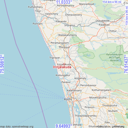
Irinjālakuda GPS coordinates[2]
10° 20' 32.568" North, 76° 12' 40.464" East
| Map corner | latitude | longitude |
|---|---|---|
| Upper-left | 11.0333°, | 75.50812° |
| Center: | 10.34238°, | 76.21124° |
| Lower-right: | 9.64993°, | 76.91437° |
| Map W x H: | 153.8×153.8 km | = 95.6×95.6mi |
| max Lat: | 34.9274° ⇑95.4% North |
| Irinjālakuda: | 10.34238° |
| min Lat: | ⇓4.6% South 8.09008° |
| min Long | Irinjālakuda | max Long |
| 68.82655° | 76.21124° | 96.81° |
| W 28.5%⇐ | ⇒71.5% E |
Elevation
Elevation of Irinjālakuda is 20 m = 66 ft, and this is 275.6 m = 904 ft below average elevation for this country.
| Max E: |
3681 m = 12077 ft | 88.9% |
| Avg. | 295.6 m = 970 ft | |
| Irinjālakuda | 20 m = 66 ft | |
Min E: |
1 m = 3 ft | 11.1% |
See also: India elevation on elevation.city.
Geographical zone
Irinjālakuda is located in North Torrid zone (between Equator and Tropic of Cancer). Distance of Equator is 1150 km =714.6 mi to South.| Distance of | km | miles | from Irinjālakuda |
|---|---|---|---|
| North Pole | 8857.1 | 5503.5 | to North |
| Arctic Circle | 6251.2 | 3884.3 | to North |
| Tropic Cancer | 1456 | 904.7 | to North |
| Equator | 1150 | 714.6 | to South |


Nearby cities:
15 places around Irinjālakuda: (largest is in red/bold)
• Aluva
30.3 km =18.8 mi,  149°
149°
• Alwaye
30.6 km =19 mi, 149°
• Angamāli
25.7 km =16 mi,  131°
131°
• Avanoor
29.8 km =18.5 mi,  352°
352°
• Chetwayi
27.4 km =17 mi,  319°
319°
• Edakkulam
29.9 km =18.6 mi, 354°
• Elūr
31.7 km =19.7 mi,  165°
165°
• Guruvāyūr
33.6 km =20.9 mi,  326°
326°
• Kalamassery
33.7 km =20.9 mi,  158°
158°
• Kizhake Chālakudi
14.6 km =9.1 mi,  108°
108°
• Kodungallūr
12.3 km =7.6 mi,  188°
188°
• Kunnamkulam
37.3 km =23.2 mi,  335°
335°
• Perumpāvūr
38.4 km =23.9 mi, 131°
• Thanniyam
11.9 km =7.4 mi,  314°
314°
• Thrissur
19.4 km =12.1 mi,  1°
1°
Sources, notices
• [Note1] Compared only with cities in India existing in our database
• [Src1] Map data: © OpenStreetMap contributors (CC-BY-SA)
• [Src2] Other city data from geonames.org with taken over terms of usage.
• [Src3] Geographical zone / Annual Mean Temperature by Robert A. Rohde @ Wikipedia
