Raypur geodata
Raypur (West Bengal) is a populated place; located in India in Asia/Kolkata (GMT+5.5) time zone. With population of 6,907 people, there are 3217 cities with bigger population in this country. Compared to other cities in India, 53.7% of cities are located further ↑North; 94.3% of cities are located further ←West and 96.4% of cities have higher elevation than Raypur. Note1


Raypur GPS coordinates[2]
22° 24' 38.988" North, 88° 30' 33.984" East
| Map corner | latitude | longitude |
|---|---|---|
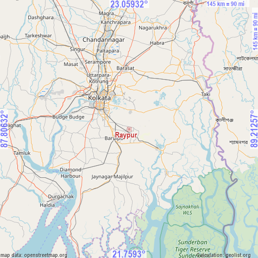
| Upper-left | 23.05932°, | 87.80632° |
| Center: | 22.41083°, | 88.50944° |
| Lower-right: | 21.7593°, | 89.21257° |
| Map W x H: | 144.5×144.6 km | = 89.8×89.9mi |
| max Lat: | 34.9274° ⇑53.7% North |
| Raypur: | 22.41083° |
| min Lat: | ⇓46.3% South 8.09008° |
| min Long | Raypur | max Long |
| 68.82655° | 88.50944° | 96.81° |
| W 94.3%⇐ | ⇒5.7% E |
Elevation
Elevation of Raypur is 10 m = 33 ft, and this is 285.6 m = 937 ft below average elevation for this country.
| Max E: |
3681 m = 12077 ft | 96.4% |
| Avg. | 295.6 m = 970 ft | |
| Raypur | 10 m = 33 ft | |
Min E: |
1 m = 3 ft | 3.6% |
See also: India elevation on elevation.city.
Geographical zone
Raypur is located in North Torrid zone (between Equator and Tropic of Cancer). Distance of this Northern Tropic circle is 114.1 km =70.9 mi to North.| Distance of | km | miles | from Raypur |
|---|---|---|---|
| North Pole | 7515.2 | 4669.7 | to North |
| Arctic Circle | 4909.3 | 3050.5 | to North |
| Tropic Cancer | 114.1 | 70.9 | to North |
| Equator | 2491.9 | 1548.4 | to South |


Nearby cities:
15 places around Raypur: (largest is in red/bold)
• Amtala
24.1 km =15 mi,  259°
259°
• Balarāmpur
23.4 km =14.5 mi,  248°
248°
• Bara Bazar
23.8 km =14.8 mi,  316°
316°
• Bishnupur
24.5 km =15.2 mi, 261°
• Bāruipur
9.7 km =6 mi,  228°
228°
• Bārāsat
21.5 km =13.4 mi,  196°
196°
• Canning
19 km =11.8 mi,  124°
124°
• Chāmpāhāti
2.1 km =1.3 mi,  236°
236°
• Dam Dam
26.3 km =16.3 mi,  340°
340°
• Garui
27.2 km =16.9 mi, 335°
• Hāora
26.9 km =16.7 mi,  313°
313°
• Kolkata
22.6 km =14 mi, 318°
• Nabagrām
13.7 km =8.5 mi,  180°
180°
• Santoshpur
27.5 km =17.1 mi,  296°
296°
• Serpur
22.9 km =14.2 mi, 244°
Sources, notices
• [Note1] Compared only with cities in India existing in our database
• [Src1] Map data: © OpenStreetMap contributors (CC-BY-SA)
• [Src2] Other city data from geonames.org with taken over terms of usage.
• [Src3] Geographical zone / Annual Mean Temperature by Robert A. Rohde @ Wikipedia
