Basrah geodata
Basrah (Basra) is a seat of a first-order administrative division; located in Iraq in Asia/Baghdad (GMT+3) time zone. With population of 2,600,000 people, there is 1 city with bigger population in this country. Compared to other cities in Iraq, 94.4% of cities are located further ↑North; 95.8% of cities are located further ←West and 96.5% of cities have higher elevation than Basrah. Note1


Basrah GPS coordinates[2]
30° 30' 30.672" North, 47° 46' 49.44" East
| Map corner | latitude | longitude |
|---|---|---|
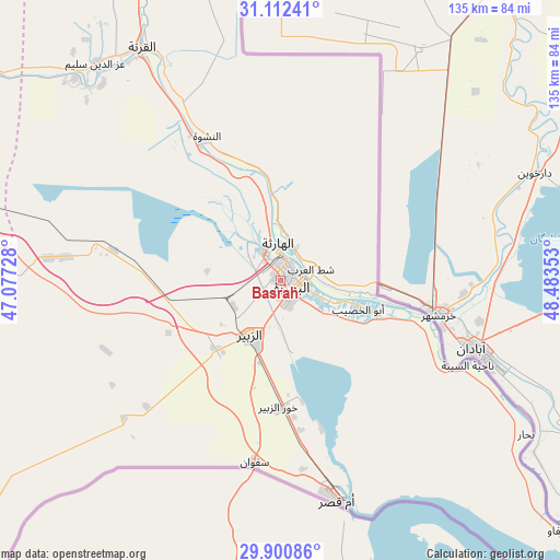
| Upper-left | 31.11241°, | 47.07728° |
| Center: | 30.50852°, | 47.7804° |
| Lower-right: | 29.90086°, | 48.48353° |
| Map W x H: | 134.7×134.7 km | = 83.7×83.7mi |
| max Lat: | 37.22781° ⇑94.4% North |
| Basrah: | 30.50852° |
| min Lat: | ⇓5.6% South 29.97421° |
| min Long | Basrah | max Long |
| 40.28586° | 47.7804° | 48.47309° |
| W 95.8%⇐ | ⇒4.2% E |
Elevation
Elevation of Basrah is 4 m = 13 ft, and this is 289 m = 948 ft below average elevation for this country.
| Max E: |
1316 m = 4318 ft | 96.5% |
| Avg. | 293 m = 961 ft | |
| Basrah | 4 m = 13 ft | |
Min E: |
1 m = 3 ft | 3.5% |
See also: Basrah elevation on elevation.city.
Geographical zone
Basrah is located in North temperate zone (between Tropic of Cancer and the Arctic Circle). Distance of this Northern Tropic circle is 786.3 km =488.6 mi to South.| Distance of | km | miles | from Basrah |
|---|---|---|---|
| North Pole | 6614.8 | 4110.2 | to North |
| Arctic Circle | 4008.9 | 2491 | to North |
| Tropic Cancer | 786.3 | 488.6 | to South |
| Equator | 3392.2 | 2107.8 | to South |


Nearby cities:
15 places around Basrah: (largest is in red/bold)
• Abī al Khaşīb
20.2 km =12.6 mi,  110°
110°
• Al Başrah al Qadīmah
3.4 km =2.1 mi,  100°
100°
• Al Fāw
89.2 km =55.4 mi,  131°
131°
• Al Hārithah
8.7 km =5.4 mi,  347°
347°
• Al Jabāyish
90.1 km =56 mi,  304°
304°
• Al Kaḩlā’
137 km =85.1 mi,  340°
340°
• Al Madīnah
70.3 km =43.7 mi,  316°
316°
• Al Qurnah
65.4 km =40.6 mi,  329°
329°
• Az Zubayr
15 km =9.3 mi,  210°
210°
• Nāḩiyat Baḩār
69.8 km =43.4 mi,  121°
121°
• Nāḩiyat al Fuhūd
113.3 km =70.4 mi, 296°
• Nāḩiyat ‘Atbah
22.6 km =14 mi, 97°
• Qal‘at Şāliḩ
122.5 km =76.1 mi, 337°
• Sūq ash Shuyūkh
133.7 km =83.1 mi,  288°
288°
• Umm Qaşr
54.2 km =33.7 mi,  165°
165°
In other languages:
- In Spanish: Basora
- In France: Bassorah
- In German: Basra
- In Italian: Bàssora
- In Russian: Басра
- In Chinese: 巴士拉, 巴斯拉
Sources, notices
• [Note1] Compared only with cities in Iraq existing in our database
• [Src1] Map data: © OpenStreetMap contributors (CC-BY-SA)
• [Src2] Other city data from geonames.org with taken over terms of usage.
• [Src3] Geographical zone / Annual Mean Temperature by Robert A. Rohde @ Wikipedia
