Termini Imerese geodata
Termini Imerese (Sicily) is a seat of a third-order administrative division; located in Italy in Europe/Rome (GMT+2) time zone. With population of 22,957 people, there are 371 cities with bigger population in this country. Compared to other cities in Italy, 96.8% of cities are located further ↑North; 75.6% of cities are located further ←West and 79.6% of cities have higher elevation than Termini Imerese. Note1


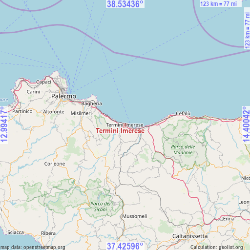
Termini Imerese GPS coordinates[2]
37° 58' 56.1" North, 13° 41' 50.244" East
| Map corner | latitude | longitude |
|---|---|---|
| Upper-left | 38.53436°, | 12.99417° |
| Center: | 37.98225°, | 13.69729° |
| Lower-right: | 37.42596°, | 14.40042° |
| Map W x H: | 123.2×123.2 km | = 76.6×76.6mi |
| max Lat: | 47.04031° ⇑96.8% North |
| Termini Imerese: | 37.98225° |
| min Lat: | ⇓3.2% South 35.50142° |
| min Long | Termini Imerese | max Long |
| 6.69888° | 13.69729° | 18.48682° |
| W 75.6%⇐ | ⇒24.4% E |
Elevation
Elevation of Termini Imerese is 52 m = 171 ft, and this is 254.7 m = 836 ft below average elevation for this country.
| Max E: |
2085 m = 6841 ft | 79.6% |
| Avg. | 306.7 m = 1006 ft | |
| Termini Imerese | 52 m = 171 ft | |
Min E: |
-4 m = -13 ft | 20.4% |
See also: Italy elevation on elevation.city.
Geographical zone
Termini Imerese is located in North temperate zone (between Tropic of Cancer and the Arctic Circle). Distance of this Northern Tropic circle is 1617.3 km =1004.9 mi to South.| Distance of | km | miles | from Termini Imerese |
|---|---|---|---|
| North Pole | 5783.8 | 3593.9 | to North |
| Arctic Circle | 3177.9 | 1974.7 | to North |
| Tropic Cancer | 1617.3 | 1004.9 | to South |
| Equator | 4223.2 | 2624.2 | to South |


Nearby cities:
15 places around Termini Imerese: (largest is in red/bold)
• Aliminusa
15.1 km =9.4 mi,  150°
150°
• Altavilla Milicia
14.4 km =8.9 mi,  295°
295°
• Baucina
15.5 km =9.6 mi,  245°
245°
• C.da Ponticello
1.7 km =1.1 mi,  128°
128°
• Caccamo
6 km =3.7 mi,  205°
205°
• Campofelice di Roccella
15.7 km =9.8 mi,  85°
85°
• Casteldaccia
16.5 km =10.3 mi, 297°
• Cerda
13.4 km =8.3 mi, 129°
• Ciminna
15.3 km =9.5 mi,  232°
232°
• Montemaggiore Belsito
16 km =9.9 mi,  159°
159°
• Piana Calzata
18.1 km =11.2 mi,  82°
82°
• Sciara
9.4 km =5.8 mi,  142°
142°
• Torre Colonna-Sperone
12 km =7.5 mi, 296°
• Trabia
6.1 km =3.8 mi,  293°
293°
• Ventimiglia di Sicilia
13.1 km =8.1 mi,  240°
240°
Sources, notices
• [Note1] Compared only with cities in Italy existing in our database
• [Src1] Map data: © OpenStreetMap contributors (CC-BY-SA)
• [Src2] Other city data from geonames.org with taken over terms of usage.
• [Src3] Geographical zone / Annual Mean Temperature by Robert A. Rohde @ Wikipedia
