Casteldaccia geodata
Casteldaccia (Sicily) is a seat of a third-order administrative division; located in Italy in Europe/Rome (GMT+2) time zone. With population of 10,091 people, there are 942 cities with bigger population in this country. Compared to other cities in Italy, 96.1% of cities are located further ↑North; 73.9% of cities are located further ←West and 70.4% of cities have higher elevation than Casteldaccia. Note1


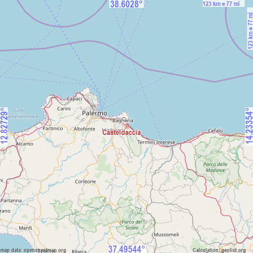
Casteldaccia GPS coordinates[2]
38° 3' 4.356" North, 13° 31' 49.476" East
| Map corner | latitude | longitude |
|---|---|---|
| Upper-left | 38.6028°, | 12.82729° |
| Center: | 38.05121°, | 13.53041° |
| Lower-right: | 37.49544°, | 14.23354° |
| Map W x H: | 123.1×123.1 km | = 76.5×76.5mi |
| max Lat: | 47.04031° ⇑96.1% North |
| Casteldaccia: | 38.05121° |
| min Lat: | ⇓3.9% South 35.50142° |
| min Long | Casteldaccia | max Long |
| 6.69888° | 13.53041° | 18.48682° |
| W 73.9%⇐ | ⇒26.1% E |
Elevation
Elevation of Casteldaccia is 95 m = 312 ft, and this is 211.7 m = 695 ft below average elevation for this country.
| Max E: |
2085 m = 6841 ft | 70.4% |
| Avg. | 306.7 m = 1006 ft | |
| Casteldaccia | 95 m = 312 ft | |
Min E: |
-4 m = -13 ft | 29.6% |
See also: Italy elevation on elevation.city.
Geographical zone
Casteldaccia is located in North temperate zone (between Tropic of Cancer and the Arctic Circle). Distance of this Northern Tropic circle is 1625 km =1009.7 mi to South.| Distance of | km | miles | from Casteldaccia |
|---|---|---|---|
| North Pole | 5776.2 | 3589.2 | to North |
| Arctic Circle | 3170.3 | 1969.9 | to North |
| Tropic Cancer | 1625 | 1009.7 | to South |
| Equator | 4230.9 | 2629 | to South |


Nearby cities:
15 places around Casteldaccia: (largest is in red/bold)
• Altavilla Milicia
2.2 km =1.4 mi,  131°
131°
• Bagheria
3.5 km =2.2 mi,  332°
332°
• Baucina
14 km =8.7 mi,  177°
177°
• Belmonte Mezzagno
12.1 km =7.5 mi,  267°
267°
• Bolognetta
11 km =6.8 mi,  216°
216°
• Ciaculli
11.1 km =6.9 mi,  283°
283°
• Ficarazzelli-Bagni Italia
8.2 km =5.1 mi,  298°
298°
• Ficarazzi
7.4 km =4.6 mi,  308°
308°
• Misilmeri
7.5 km =4.7 mi,  253°
253°
• Piano Pantaleo
8.4 km =5.2 mi,  264°
264°
• Portella di Mare
6.5 km =4 mi,  292°
292°
• Santa Flavia
5.9 km =3.7 mi,  2°
2°
• Torre Colonna-Sperone
4.5 km =2.8 mi,  122°
122°
• Trabia
10.5 km =6.5 mi, 119°
• Villabate
8.2 km =5.1 mi, 291°
Sources, notices
• [Note1] Compared only with cities in Italy existing in our database
• [Src1] Map data: © OpenStreetMap contributors (CC-BY-SA)
• [Src2] Other city data from geonames.org with taken over terms of usage.
• [Src3] Geographical zone / Annual Mean Temperature by Robert A. Rohde @ Wikipedia
