San Paolo-Cannistrà geodata
San Paolo-Cannistrà (Sicily) is a populated place; located in Italy in Europe/Rome (GMT+2) time zone. With population of 737 people, there are 8041 cities with bigger population in this country. Compared to other cities in Italy, 95.5% of cities are located further ↑North; 89.1% of cities are located further ←West and 58.4% of cities have higher elevation than San Paolo-Cannistrà. Note1


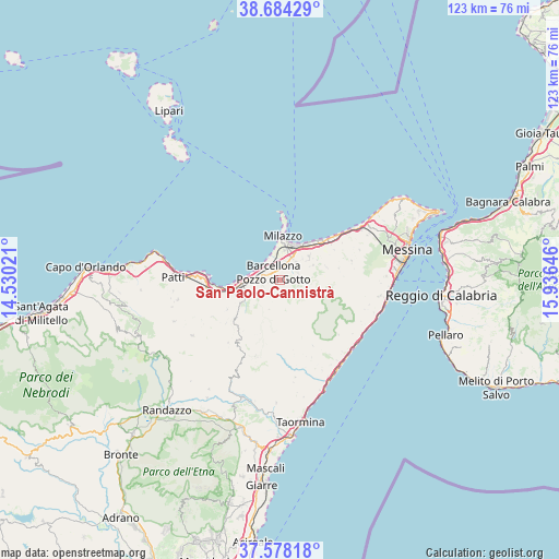
San Paolo-Cannistrà GPS coordinates[2]
38° 7' 59.988" North, 15° 13' 59.988" East
| Map corner | latitude | longitude |
|---|---|---|
| Upper-left | 38.68429°, | 14.53021° |
| Center: | 38.13333°, | 15.23333° |
| Lower-right: | 37.57818°, | 15.93646° |
| Map W x H: | 123×123 km | = 76.4×76.4mi |
| max Lat: | 47.04031° ⇑95.5% North |
| San Paolo-Cannistrà: | 38.13333° |
| min Lat: | ⇓4.5% South 35.50142° |
| min Long | San Paolo-Canni | max Long |
| 6.69888° | 15.23333° | 18.48682° |
| W 89.1%⇐ | ⇒10.9% E |
Elevation
Elevation of San Paolo-Cannistrà is 176 m = 577 ft, and this is 130.7 m = 429 ft below average elevation for this country.
| Max E: |
2085 m = 6841 ft | 58.4% |
| Avg. | 306.7 m = 1006 ft | |
| San Paolo-Cannistrà | 176 m = 577 ft | |
Min E: |
-4 m = -13 ft | 41.6% |
See also: Italy elevation on elevation.city.
Geographical zone
San Paolo-Cannistrà is located in North temperate zone (between Tropic of Cancer and the Arctic Circle). Distance of this Northern Tropic circle is 1634.1 km =1015.4 mi to South.| Distance of | km | miles | from San Paolo-Cannistrà |
|---|---|---|---|
| North Pole | 5767 | 3583.4 | to North |
| Arctic Circle | 3161.1 | 1964.2 | to North |
| Tropic Cancer | 1634.1 | 1015.4 | to South |
| Equator | 4240 | 2634.6 | to South |


Nearby cities:
15 places around San Paolo-Cannistrà: (largest is in red/bold)
• Acquaficara
2.3 km =1.4 mi,  258°
258°
• Archi
7.7 km =4.8 mi,  27°
27°
• Bafia
7 km =4.3 mi,  200°
200°
• Barcellona Pozzo di Gotto
2.3 km =1.4 mi,  314°
314°
• Castroreale
4.4 km =2.7 mi,  207°
207°
• Gualtieri Sicaminò
8 km =5 mi,  65°
65°
• La Gala
1.7 km =1.1 mi,  187°
187°
• Merì
3.9 km =2.4 mi,  21°
21°
• Pace del Mela
8.2 km =5.1 mi,  50°
50°
• Protonotaro
3.8 km =2.4 mi,  248°
248°
• Rodì
6.3 km =3.9 mi,  243°
243°
• San Filippo del Mela
5.4 km =3.4 mi,  40°
40°
• Santa Lucia del Mela
4.3 km =2.7 mi, 73°
• Terme
6.7 km =4.2 mi,  272°
272°
• Vigliatore 2
9.1 km =5.7 mi, 262°
Sources, notices
• [Note1] Compared only with cities in Italy existing in our database
• [Src1] Map data: © OpenStreetMap contributors (CC-BY-SA)
• [Src2] Other city data from geonames.org with taken over terms of usage.
• [Src3] Geographical zone / Annual Mean Temperature by Robert A. Rohde @ Wikipedia
