Pannaconi geodata
Pannaconi (Calabria) is a populated place; located in Italy in Europe/Rome (GMT+2) time zone. With population of 1,333 people, there are 5537 cities with bigger population in this country. Compared to other cities in Italy, 93.4% of cities are located further ↑North; 93% of cities are located further ←West and 52.2% of cities have higher elevation than Pannaconi. Note1
Administrative division(s):
- Level 1: Calabria
- Level 2: Provincia di Vibo-Valentia
- Level 3: Cessaniti


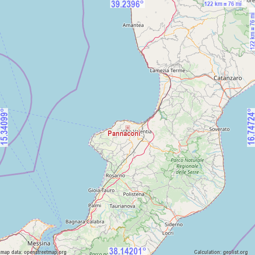
Pannaconi GPS coordinates[2]
38° 41' 34.476" North, 16° 2' 38.796" East
| Map corner | latitude | longitude |
|---|---|---|
| Upper-left | 39.2396°, | 15.34099° |
| Center: | 38.69291°, | 16.04411° |
| Lower-right: | 38.14201°, | 16.74724° |
| Map W x H: | 122×122 km | = 75.8×75.8mi |
| max Lat: | 47.04031° ⇑93.4% North |
| Pannaconi: | 38.69291° |
| min Lat: | ⇓6.6% South 35.50142° |
| min Long | Pannaconi | max Long |
| 6.69888° | 16.04411° | 18.48682° |
| W 93%⇐ | ⇒7% E |
Elevation
Elevation of Pannaconi is 221 m = 725 ft, and this is 85.7 m = 281 ft below average elevation for this country.
| Max E: |
2085 m = 6841 ft | 52.2% |
| Avg. | 306.7 m = 1006 ft | |
| Pannaconi | 221 m = 725 ft | |
Min E: |
-4 m = -13 ft | 47.8% |
See also: Italy elevation on elevation.city.
Geographical zone
Pannaconi is located in North temperate zone (between Tropic of Cancer and the Arctic Circle). Distance of this Northern Tropic circle is 1696.3 km =1054 mi to South.| Distance of | km | miles | from Pannaconi |
|---|---|---|---|
| North Pole | 5704.8 | 3544.8 | to North |
| Arctic Circle | 3098.9 | 1925.6 | to North |
| Tropic Cancer | 1696.3 | 1054 | to South |
| Equator | 4302.2 | 2673.3 | to South |


Nearby cities:
15 places around Pannaconi: (largest is in red/bold)
• Arzona-Pizzinni
7.6 km =4.7 mi,  178°
178°
• Briatico
3.6 km =2.2 mi,  336°
336°
• Cessaniti
3.5 km =2.2 mi,  201°
201°
• Filandari
8.7 km =5.4 mi,  187°
187°
• Jonadi
7.2 km =4.5 mi,  168°
168°
• Longobardi
6.8 km =4.2 mi,  79°
79°
• Piscopio
6.7 km =4.2 mi,  119°
119°
• San Costantino
3.8 km =2.4 mi,  290°
290°
• San Costantino Calabro
7.2 km =4.5 mi,  157°
157°
• San Gregorio d'Ippona
7.4 km =4.6 mi,  135°
135°
• Sant'Onofrio
9 km =5.6 mi,  86°
86°
• Stefanaconi
7.1 km =4.4 mi,  103°
103°
• Vibo Valentia
5.3 km =3.3 mi,  110°
110°
• Zambrone
4.8 km =3 mi,  277°
277°
• Zungri
6.6 km =4.1 mi,  232°
232°
Sources, notices
• [Note1] Compared only with cities in Italy existing in our database
• [Src1] Map data: © OpenStreetMap contributors (CC-BY-SA)
• [Src2] Other city data from geonames.org with taken over terms of usage.
• [Src3] Geographical zone / Annual Mean Temperature by Robert A. Rohde @ Wikipedia
