Loceri geodata
Loceri (Sardinia) is a seat of a third-order administrative division; located in Italy in Europe/Rome (GMT+2) time zone. With population of 1,081 people, there are 6366 cities with bigger population in this country. Compared to other cities in Italy, 88.8% of cities are located further ↑North; 72.2% of cities are located further →East and 53.6% of cities have higher elevation than Loceri. Note1


Loceri GPS coordinates[2]
39° 51' 29.376" North, 9° 35' 1.248" East
| Map corner | latitude | longitude |
|---|---|---|
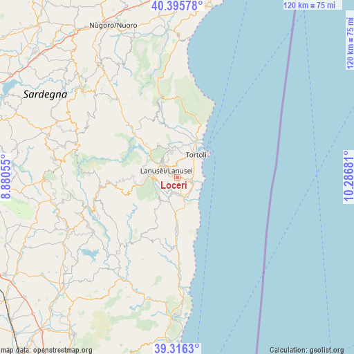
| Upper-left | 40.39578°, | 8.88055° |
| Center: | 39.85816°, | 9.58368° |
| Lower-right: | 39.3163°, | 10.28681° |
| Map W x H: | 120×120 km | = 74.6×74.6mi |
| max Lat: | 47.04031° ⇑88.8% North |
| Loceri: | 39.85816° |
| min Lat: | ⇓11.2% South 35.50142° |
| min Long | Loceri | max Long |
| 6.69888° | 9.58368° | 18.48682° |
| W 27.8%⇐ | ⇒72.2% E |
Elevation
Elevation of Loceri is 213 m = 699 ft, and this is 93.7 m = 307 ft below average elevation for this country.
| Max E: |
2085 m = 6841 ft | 53.6% |
| Avg. | 306.7 m = 1006 ft | |
| Loceri | 213 m = 699 ft | |
Min E: |
-4 m = -13 ft | 46.4% |
See also: Italy elevation on elevation.city.
Geographical zone
Loceri is located in North temperate zone (between Tropic of Cancer and the Arctic Circle). Distance of this Northern Tropic circle is 1825.9 km =1134.6 mi to South.| Distance of | km | miles | from Loceri |
|---|---|---|---|
| North Pole | 5575.2 | 3464.3 | to North |
| Arctic Circle | 2969.4 | 1845.1 | to North |
| Tropic Cancer | 1825.9 | 1134.6 | to South |
| Equator | 4431.8 | 2753.8 | to South |


Nearby cities:
15 places around Loceri: (largest is in red/bold)
• Arbatax
13.4 km =8.3 mi,  50°
50°
• Arzana
8.1 km =5 mi,  324°
324°
• Bari Sardo
5.6 km =3.5 mi,  109°
109°
• Cardedu
7.7 km =4.8 mi,  151°
151°
• Elini
6.4 km =4 mi, 316°
• Gairo Sant'Elena
6.8 km =4.2 mi,  262°
262°
• Girasole
12.3 km =7.6 mi,  32°
32°
• Ilbono
5 km =3.1 mi, 319°
• Jerzu
9.2 km =5.7 mi,  217°
217°
• Lanusei
4.4 km =2.7 mi,  302°
302°
• Lotzorai
14.1 km =8.8 mi, 28°
• Osini
8.4 km =5.2 mi,  242°
242°
• Tortolì
9.8 km =6.1 mi,  39°
39°
• Ulassai
8.9 km =5.5 mi,  233°
233°
• Villagrande Strisaili
12.9 km =8 mi,  330°
330°
Sources, notices
• [Note1] Compared only with cities in Italy existing in our database
• [Src1] Map data: © OpenStreetMap contributors (CC-BY-SA)
• [Src2] Other city data from geonames.org with taken over terms of usage.
• [Src3] Geographical zone / Annual Mean Temperature by Robert A. Rohde @ Wikipedia
