Decimoputzu geodata
Decimoputzu (Sardinia) is a seat of a third-order administrative division; located in Italy in Europe/Rome (GMT+2) time zone. With population of 3,840 people, there are 2487 cities with bigger population in this country. Compared to other cities in Italy, 91% of cities are located further ↑North; 82.5% of cities are located further →East and 91.1% of cities have higher elevation than Decimoputzu. Note1
Administrative division(s):
- Level 1: Sardinia
- Level 2: Provincia del Sud Sardegna
- Level 3: Decimoputzu


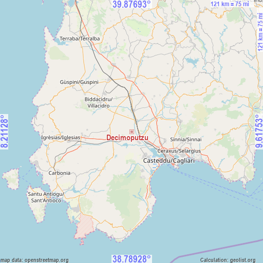
Decimoputzu GPS coordinates[2]
39° 20' 6.792" North, 8° 54' 51.84" East
| Map corner | latitude | longitude |
|---|---|---|
| Upper-left | 39.87693°, | 8.21128° |
| Center: | 39.33522°, | 8.9144° |
| Lower-right: | 38.78928°, | 9.61753° |
| Map W x H: | 120.9×120.9 km | = 75.1×75.1mi |
| max Lat: | 47.04031° ⇑91% North |
| Decimoputzu: | 39.33522° |
| min Lat: | ⇓9% South 35.50142° |
| min Long | Decimoputzu | max Long |
| 6.69888° | 8.9144° | 18.48682° |
| W 17.5%⇐ | ⇒82.5% E |
Elevation
Elevation of Decimoputzu is 16 m = 52 ft, and this is 290.7 m = 954 ft below average elevation for this country.
| Max E: |
2085 m = 6841 ft | 91.1% |
| Avg. | 306.7 m = 1006 ft | |
| Decimoputzu | 16 m = 52 ft | |
Min E: |
-4 m = -13 ft | 8.9% |
See also: Italy elevation on elevation.city.
Geographical zone
Decimoputzu is located in North temperate zone (between Tropic of Cancer and the Arctic Circle). Distance of this Northern Tropic circle is 1767.7 km =1098.4 mi to South.| Distance of | km | miles | from Decimoputzu |
|---|---|---|---|
| North Pole | 5633.4 | 3500.4 | to North |
| Arctic Circle | 3027.5 | 1881.2 | to North |
| Tropic Cancer | 1767.7 | 1098.4 | to South |
| Equator | 4373.7 | 2717.7 | to South |


Nearby cities:
15 places around Decimoputzu: (largest is in red/bold)
• Assemini
8.8 km =5.5 mi,  123°
123°
• Cortexandra
14.3 km =8.9 mi,  110°
110°
• Decimomannu
5.5 km =3.4 mi, 120°
• Elmas
13.8 km =8.6 mi, 122°
• Monastir
12.4 km =7.7 mi,  64°
64°
• Nuraminis
14.7 km =9.1 mi,  35°
35°
• San Sperate
8.4 km =5.2 mi,  72°
72°
• Serramanna
9.8 km =6.1 mi,  4°
4°
• Sestu
15.9 km =9.9 mi,  104°
104°
• Siliqua
10.1 km =6.3 mi,  247°
247°
• Ussana
15.3 km =9.5 mi, 64°
• Uta
5.8 km =3.6 mi,  145°
145°
• Vallermosa
10.7 km =6.6 mi,  287°
287°
• Villasor
5.7 km =3.5 mi,  25°
25°
• Villaspeciosa
2.8 km =1.7 mi,  159°
159°
Sources, notices
• [Note1] Compared only with cities in Italy existing in our database
• [Src1] Map data: © OpenStreetMap contributors (CC-BY-SA)
• [Src2] Other city data from geonames.org with taken over terms of usage.
• [Src3] Geographical zone / Annual Mean Temperature by Robert A. Rohde @ Wikipedia
