Alliste geodata
Alliste (Apulia) is a seat of a third-order administrative division; located in Italy in Europe/Rome (GMT+2) time zone. With population of 4,543 people, there are 2127 cities with bigger population in this country. Compared to other cities in Italy, 88.3% of cities are located further ↑North; 99.1% of cities are located further ←West and 80.1% of cities have higher elevation than Alliste. Note1


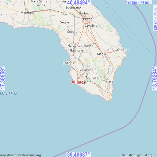
Alliste GPS coordinates[2]
39° 56' 52.908" North, 18° 5' 22.956" East
| Map corner | latitude | longitude |
|---|---|---|
| Upper-left | 40.48494°, | 17.38659° |
| Center: | 39.94803°, | 18.08971° |
| Lower-right: | 39.40687°, | 18.79284° |
| Map W x H: | 119.9×119.9 km | = 74.5×74.5mi |
| max Lat: | 47.04031° ⇑88.3% North |
| Alliste: | 39.94803° |
| min Lat: | ⇓11.7% South 35.50142° |
| min Long | Alliste | max Long |
| 6.69888° | 18.08971° | 18.48682° |
| W 99.1%⇐ | ⇒0.90000000000001% E |
Elevation
Elevation of Alliste is 49 m = 161 ft, and this is 257.7 m = 845 ft below average elevation for this country.
| Max E: |
2085 m = 6841 ft | 80.1% |
| Avg. | 306.7 m = 1006 ft | |
| Alliste | 49 m = 161 ft | |
Min E: |
-4 m = -13 ft | 19.9% |
See also: Italy elevation on elevation.city.
Geographical zone
Alliste is located in North temperate zone (between Tropic of Cancer and the Arctic Circle). Distance of this Northern Tropic circle is 1835.9 km =1140.8 mi to South.| Distance of | km | miles | from Alliste |
|---|---|---|---|
| North Pole | 5565.3 | 3458.1 | to North |
| Arctic Circle | 2959.4 | 1838.9 | to North |
| Tropic Cancer | 1835.9 | 1140.8 | to South |
| Equator | 4441.8 | 2760 | to South |


Nearby cities:
15 places around Alliste: (largest is in red/bold)
• Alezio
13 km =8.1 mi,  347°
347°
• Casarano
9.4 km =5.8 mi,  41°
41°
• Felline
2.7 km =1.7 mi,  117°
117°
• Gemini
9.3 km =5.8 mi, 116°
• Marina di Mancaversa
6.1 km =3.8 mi,  289°
289°
• Matino
10 km =6.2 mi,  23°
23°
• Melissano
3.9 km =2.4 mi, 43°
• Parabita
11.9 km =7.4 mi, 15°
• Racale
1.4 km =0.9 mi,  6°
6°
• Taurisano
10.7 km =6.6 mi,  84°
84°
• Taviano
3.9 km =2.4 mi, 349°
• Torre San Giovanni
6.7 km =4.2 mi,  163°
163°
• Torre Suda
4.8 km =3 mi,  280°
280°
• Tuglie
14 km =8.7 mi,  3°
3°
• Ugento
6.3 km =3.9 mi,  111°
111°
Sources, notices
• [Note1] Compared only with cities in Italy existing in our database
• [Src1] Map data: © OpenStreetMap contributors (CC-BY-SA)
• [Src2] Other city data from geonames.org with taken over terms of usage.
• [Src3] Geographical zone / Annual Mean Temperature by Robert A. Rohde @ Wikipedia
