Viola geodata
Viola (Piedmont) is a seat of a third-order administrative division; located in Italy in Europe/Rome (GMT+2) time zone. With population of 191 people, there are 11165 cities with bigger population in this country. Compared to other cities in Italy, 52% of cities are located further ↑North; 94% of cities are located further →East and 94.4% of cities have lower elevation than Viola. Note1


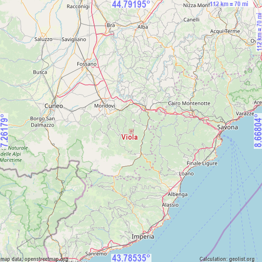
Viola GPS coordinates[2]
44° 17' 26.916" North, 7° 57' 53.676" East
| Map corner | latitude | longitude |
|---|---|---|
| Upper-left | 44.79195°, | 7.26179° |
| Center: | 44.29081°, | 7.96491° |
| Lower-right: | 43.78535°, | 8.66804° |
| Map W x H: | 111.9×111.9 km | = 69.5×69.5mi |
| max Lat: | 47.04031° ⇑52% North |
| Viola: | 44.29081° |
| min Lat: | ⇓48% South 35.50142° |
| min Long | Viola | max Long |
| 6.69888° | 7.96491° | 18.48682° |
| W 6%⇐ | ⇒94% E |
Elevation
Elevation of Viola is 850 m = 2789 ft, and this is 543.3 m = 1782 ft above average elevation for this country.
| Max E: |
2085 m = 6841 ft | 5.6% |
| Viola | 850 m 2789 ft | |
| Avg. | 306.7 m = 1006 ft | |
Min E: |
-4 m = -13 ft | 94.4% |
See also: Italy elevation on elevation.city.
Geographical zone
Viola is located in North temperate zone (between Tropic of Cancer and the Arctic Circle). Distance of this Northern Tropic circle is 2318.8 km =1440.8 mi to South.| Distance of | km | miles | from Viola |
|---|---|---|---|
| North Pole | 5082.4 | 3158.1 | to North |
| Arctic Circle | 2476.5 | 1538.8 | to North |
| Tropic Cancer | 2318.8 | 1440.8 | to South |
| Equator | 4924.7 | 3060.1 | to South |


Nearby cities:
15 places around Viola: (largest is in red/bold)
• Bagnasco
6.6 km =4.1 mi,  76°
76°
• Battifollo
4.9 km =3 mi,  48°
48°
• Garessio
10.2 km =6.3 mi,  155°
155°
• Lisio
2.1 km =1.3 mi,  31°
31°
• Massimino
8.5 km =5.3 mi, 83°
• Mombasiglio
8.4 km =5.2 mi,  1°
1°
• Monasterolo Casotto
4.5 km =2.8 mi,  337°
337°
• Montaldo di Mondovì
8.5 km =5.3 mi,  293°
293°
• Nucetto
9.3 km =5.8 mi, 54°
• Pamparato
4.3 km =2.7 mi,  248°
248°
• Priola
6.8 km =4.2 mi,  138°
138°
• Roburent
6 km =3.7 mi, 286°
• San Michele Mondovì
10.5 km =6.5 mi,  334°
334°
• Scagnello
5 km =3.1 mi,  19°
19°
• Torre Mondovì
8.6 km =5.3 mi,  323°
323°
Sources, notices
• [Note1] Compared only with cities in Italy existing in our database
• [Src1] Map data: © OpenStreetMap contributors (CC-BY-SA)
• [Src2] Other city data from geonames.org with taken over terms of usage.
• [Src3] Geographical zone / Annual Mean Temperature by Robert A. Rohde @ Wikipedia
