Villanova d'Ardenghi geodata
Villanova d'Ardenghi (Lombardy) is a seat of a third-order administrative division; located in Italy in Europe/Rome (GMT+2) time zone. With population of 716 people, there are 8181 cities with bigger population in this country. Compared to other cities in Italy, 64.3% of cities are located further ↓South; 80.7% of cities are located further →East and 72.5% of cities have higher elevation than Villanova d'Ardenghi. Note1
Administrative division(s):
- Level 1: Lombardy
- Level 2: Provincia di Pavia
- Level 3: Villanova d'Ardenghi


Villanova d'Ardenghi GPS coordinates[2]
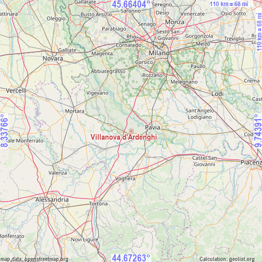
45° 10' 13.764" North, 9° 2' 26.808" East
| Map corner | latitude | longitude |
|---|---|---|
| Upper-left | 45.66404°, | 8.33766° |
| Center: | 45.17049°, | 9.04078° |
| Lower-right: | 44.67263°, | 9.74391° |
| Map W x H: | 110.2×110.2 km | = 68.5×68.5mi |
| max Lat: | 47.04031° ⇑35.7% North |
| Villanova d'Ardenghi: | 45.17049° |
| min Lat: | ⇓64.3% South 35.50142° |
| min Long | Villanova d'Ard | max Long |
| 6.69888° | 9.04078° | 18.48682° |
| W 19.3%⇐ | ⇒80.7% E |
Elevation
Elevation of Villanova d'Ardenghi is 85 m = 279 ft, and this is 221.7 m = 727 ft below average elevation for this country.
| Max E: |
2085 m = 6841 ft | 72.5% |
| Avg. | 306.7 m = 1006 ft | |
| Villanova d'Ardenghi | 85 m = 279 ft | |
Min E: |
-4 m = -13 ft | 27.5% |
See also: Italy elevation on elevation.city.
Geographical zone
Villanova d'Ardenghi is located in North temperate zone (between Tropic of Cancer and the Arctic Circle). Distance of this North polar circle is 2378.7 km =1478.1 mi to North.| Distance of | km | miles | from Villanova d'Ardenghi |
|---|---|---|---|
| North Pole | 4984.6 | 3097.3 | to North |
| Arctic Circle | 2378.7 | 1478.1 | to North |
| Tropic Cancer | 2416.6 | 1501.6 | to South |
| Equator | 5022.5 | 3120.8 | to South |


Nearby cities:
15 places around Villanova d'Ardenghi: (largest is in red/bold)
• Bivio Cava Manara
7 km =4.3 mi,  116°
116°
• Carbonara al Ticino
2 km =1.2 mi,  111°
111°
• Casottole
6.7 km =4.2 mi,  18°
18°
• Cava Manara
6.2 km =3.9 mi, 122°
• Dorno
7.3 km =4.5 mi,  255°
255°
• Gallo-Tre Re-Mezzana Corti
8.1 km =5 mi,  127°
127°
• Gropello Cairoli
3.8 km =2.4 mi,  281°
281°
• Madonna
6.9 km =4.3 mi, 107°
• Sairano
3.8 km =2.4 mi,  167°
167°
• San Martino Siccomario
7.9 km =4.9 mi,  95°
95°
• Sommo
5.5 km =3.4 mi,  139°
139°
• Torre d'Isola
6 km =3.7 mi,  27°
27°
• Zerbolò
4.5 km =2.8 mi,  332°
332°
• Zinasco Nuovo
6.2 km =3.9 mi,  209°
209°
• Zinasco Vecchio
4.8 km =3 mi,  190°
190°
Sources, notices
• [Note1] Compared only with cities in Italy existing in our database
• [Src1] Map data: © OpenStreetMap contributors (CC-BY-SA)
• [Src2] Other city data from geonames.org with taken over terms of usage.
• [Src3] Geographical zone / Annual Mean Temperature by Robert A. Rohde @ Wikipedia
