Casottole geodata
Casottole (Lombardy) is a populated place; located in Italy in Europe/Rome (GMT+2) time zone. With population of 564 people, there are 9308 cities with bigger population in this country. Compared to other cities in Italy, 65.6% of cities are located further ↓South; 80.2% of cities are located further →East and 72.8% of cities have higher elevation than Casottole. Note1


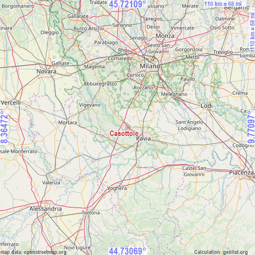
Casottole GPS coordinates[2]
45° 13' 40.98" North, 9° 4' 4.26" East
| Map corner | latitude | longitude |
|---|---|---|
| Upper-left | 45.72109°, | 8.36472° |
| Center: | 45.22805°, | 9.06785° |
| Lower-right: | 44.73069°, | 9.77097° |
| Map W x H: | 110.1×110.1 km | = 68.4×68.4mi |
| max Lat: | 47.04031° ⇑34.4% North |
| Casottole: | 45.22805° |
| min Lat: | ⇓65.6% South 35.50142° |
| min Long | Casottole | max Long |
| 6.69888° | 9.06785° | 18.48682° |
| W 19.8%⇐ | ⇒80.2% E |
Elevation
Elevation of Casottole is 84 m = 276 ft, and this is 222.7 m = 731 ft below average elevation for this country.
| Max E: |
2085 m = 6841 ft | 72.8% |
| Avg. | 306.7 m = 1006 ft | |
| Casottole | 84 m = 276 ft | |
Min E: |
-4 m = -13 ft | 27.2% |
See also: Italy elevation on elevation.city.
Geographical zone
Casottole is located in North temperate zone (between Tropic of Cancer and the Arctic Circle). Distance of this North polar circle is 2372.3 km =1474.1 mi to North.| Distance of | km | miles | from Casottole |
|---|---|---|---|
| North Pole | 4978.2 | 3093.3 | to North |
| Arctic Circle | 2372.3 | 1474.1 | to North |
| Tropic Cancer | 2423 | 1505.6 | to South |
| Equator | 5028.9 | 3124.8 | to South |


Nearby cities:
15 places around Casottole: (largest is in red/bold)
• Battuda
5.2 km =3.2 mi,  8°
8°
• Bereguardo
4.5 km =2.8 mi,  315°
315°
• Borgarello
5.9 km =3.7 mi,  76°
76°
• Cascine Calderari
4.6 km =2.9 mi,  85°
85°
• Certosa di Pavia
5.9 km =3.7 mi,  60°
60°
• Giovenzano
6.3 km =3.9 mi,  36°
36°
• Marcignago
2.9 km =1.8 mi,  17°
17°
• Torre d'Isola
1.3 km =0.8 mi,  148°
148°
• Torre del Mangano
5.6 km =3.5 mi, 61°
• Torriano
5.5 km =3.4 mi,  47°
47°
• Trivolzio
3.9 km =2.4 mi,  329°
329°
• Trovo
6.6 km =4.1 mi,  337°
337°
• Vellezzo Bellini
5.3 km =3.3 mi,  29°
29°
• Villanova d'Ardenghi
6.7 km =4.2 mi,  198°
198°
• Zerbolò
4.8 km =3 mi,  240°
240°
Sources, notices
• [Note1] Compared only with cities in Italy existing in our database
• [Src1] Map data: © OpenStreetMap contributors (CC-BY-SA)
• [Src2] Other city data from geonames.org with taken over terms of usage.
• [Src3] Geographical zone / Annual Mean Temperature by Robert A. Rohde @ Wikipedia
